Category Archives: Day hike

Alouette Mountain, 21 Sep 2014

Steve v. on Alouette Mountain:
“This was my 100th hike of the 103 Hikes book (5th edition), and one I wasn’t looking forward to. The reviews from people I knew were not positive, and it was slated to be a full 9 hours for minimal payoff. However, I’m happy to report, it exceeded my modest expectations.

I think for this hike, we hit it on the right day, with the right people. My trip partners (Laura, Lisa and Stephen), all appreciate more than just views. This trail offers a ton of forest walking including old growth and plenty of fertile mushroom areas (not to mention abundant berry patches on this trip!). The temperature was starting to feel less like summer and more like fall which was perfect for the long ascent.

The Blanchard Needle was impressive and right in your face across a deep divide, but I think to make this trip worth the time spent, you have to do the Lake Beautiful side trail (which does not add distance, it is just a choice. In there were the best parts of the old growth. To not do that, 90% of your trip feels just like sections of the Norvan Falls and Lynn Peak trails.”

Alouette Mountain, Sept 2014

Mt Elsay, 14 Sep 2014

Chris M. on Mt Elsay:
“Rob, Colleen, Pierre-Andre and I made it to the summit of Mount Elsay. We did a clockwise loop that took us through various types of North Shore terrain.

We left the main trail at the low point between Jones Peak and the true summit of Seymour. The footbed was clear as we made our way downhill. After going down some boulders we reached the snowfield below Runner Peak and took our first break. Then it was up to a rolling ridge and over towards the junctions – one goes down to the right and leads to the Elsay Lake trail, the second branches left towards Mount Bishop. We ignored them both and went straight. Straight up that is! The final section isn’t that long but the trail builder doesn’t like switchbacks. The summit provides views in all directions with plenty of spots to relax on. Which we did.

On the return trip we went down over the large boulder field towards the Elsay Lake trail. Wonderful large boulders. The others didn’t enjoy this section as much as I did, sadly. At the bottom was the only running water we saw all day and it was just a trickle. Here we stopped to admire salamanders in a mud pond. Once on the Elsay Lake trail we turned south back towards the parking lot. A Korean Group has put in a lot of effort and really brushed large sections of this trail. Once up past Wes’s Staircase we joined into the regular Seymour weekend parade below Pump Peak. It took us about 9 hours and I highly recommend this hike.”

Hanes Valley, 14 Sep 2014

Ronald W. in Hanes Valley:
“The day started with much anticipation as Jenn, Kevin, Melissa, Pooya and Ronald commenced on the Hanes Valley trail.

After 1 1⁄2 hours from the start at Lynn Headwaters, we reached the major creek crossing. The pile of carefully placed logs allowed for an easy crossing. The trail is well marked through the beautiful forest and the dry conditions made for easy hiking. Over an hour later we arrive at the helicopter pad – the perfect spot for lunch. However, minutes later the sounds of a fast approaching North Shore Rescue chopper cut our lunch short, as volunteers disembarked to search for missing hikers that set out on the Hanes Valley trail a day earlier (note: the hikers were found later that day).

The scramble up the well flagged boulder field was made easier with the shade cover from the surrounding mountains. Ensuring we could see the next flag before continuing made for a safe scramble. As we looked back down Hanes Valley the views were breathtaking. The rest of the trail from Crown Pass to the top of Grouse Mountain was a test of endurance and stamina as it entailed more elevation gain, but on a easy to follow and dry trail. Seven hours from the start we arrived at the top of Grouse Mountain. It was truly a spectacular day filled with engaging conversation, majestic beauty and physical challenges.”

Mt Currie Trail, 7 Sep 2014

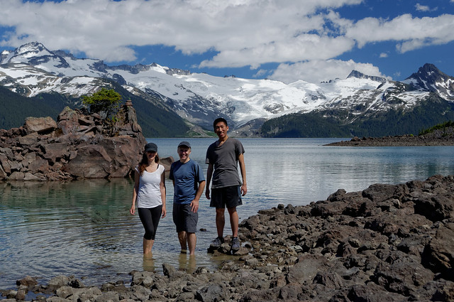
David P. on Mt Currie:
“Participants: Doug I., Lisa S., Ingrid L., Sandra G., & myself

Driving Times & Distances: 2:45 hours from Park Royal South to Trailhead, with short driving break at Nestor’s Mall in Whistler. From Whistler, travel north on Hwy 99. Set odometer to zero @ Emerald Drive. Drive 14.7 km north, then turning right @ Pemberton Speedway (note no signs for the speedway). From the turn off backtrack southwardly direction on dirt roads for ~2.5 km to Green River Bridge, passing by the Pemberton Speedway oval along the way. The Forest Service Road (FSR) starts to climb to the left (northward). Continue ~ 1 km until spotting some old skis nailed to a sign-post. Trail begins here.

Hiking Times & Distances: It took us 3 hours hiking up to the Pemberton Overlook, keeping a good pace. The return was 2.5 hours down keeping good pace too. This well graded & laid out trail is thanks to the efforts of the Pemberton Valley Trails Association, in 2013. Grades are steady, climbing ~1100 metres from the valley to the Overlook, with several fine view points also along the way. We all enjoyed the newness of the trail with its abundance of organic material covering the roots and rocks. A pleasant contrast to the over-trodden & well rain-sluiced trails like the current BCMC Trail on Grouse. However, the slope is dry and made for some dusty conditions. Options for drinking water are limited, with only one clear creek 1/2 hour from the trailhead. The hiking time & distance to the peak of Mt. Currie would about twice that of getting to the Overlook.

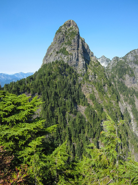
There are two peaks to Mt. Currie. The first peak (lower) is easily visible from the Overlook. The main peak of Mt. Currie, itself, can be described as “ipsoot”, or occluded from the Overlook. “Ipsoot” is Chinook Jargon for “occluded or hidden”. Oddly, there are fine views to be had of Ipsoot Mountain and Glacier across the Green River Valley.

There was a slight delay near the trailhead as there was an active helicopter logging show. Quick turn-around times allowed us to see numerous logs slewed, dropped and stacked. The loggers were very nice and let us through when the ‘copter went to re-fuel. However there was no escaping the continuous sound of the “plop, plop, plop” of the Sikorsky’s rotors, for most of the day!

Photos on Dropbox from Sandra and Lisa

Brew Lake, 1 Sep 2014

Stephen H. at Brew Lake:
“Dennis, Lisa, Rasham, Tu, and Vladimir joined me for my third and finally successful hike to Brew Lake. The hardest route-finding was at the start, driving up the logging roads to the newer trailhead. The trail itself is rugged, steep, and overgrown in parts but easy enough to find when you fall off the path. There were tons of blueberries along the trail. Fog obscured most of the views, but we did get a glimpse of Black Tusk. All in all, it was a great somewhat-rainy-day hike.”

Mystery Lake, 6 Aug 2014

Steve v. at Mystery Lake:
“Looking at the weather report I assumed it was going to be a cooking hot day worthy of an “after work” swim, but it turned out to be a bit cooler with cloud. I had 2 full cars of sign-ups and on game day we opted to hike first to Mystery Peak, then down to the lake. It turned out to be a good move making it a bit longer and by the time we reached the lake some sun had broken through. The added bonus is that Mystery Lake is probably one of the warmest mountain lakes I’ve ever been in (everyone agreed, not just my opinion!): in fact it was quite comfortable. After eating and drying off we walked out as the sun set.

While the nights are still long and warm enough, I highly suggest this trip for a weeknight evening escape. You can shorten the hike part by going directly to the lake from the parking lot and avoiding Mystery Peak.”

Mt Harvey, 27 Jul 2014

Stephen H. on Mount Harvey:
“What a tough hike. Mark, Yasuyo, Ino, Jacqui, Jenn, and Michelle joined me for the steep slog. Thankfully, there’s lots of shade until you get to the ridge. We were rewarded with a largely empty trail (everyone was over at the West Lion) and sweet views. Great, tiring day. Too bad they don’t serve iced coffee at the Lions Bay cafe.”

Tricouni Peak, 27 Jul 2014

Steve v. at Tricouni Peak:
“Did we make the peak? Almost. Did we see amazing scenery and views all around? You bet we did! This trip was one of those epic dayhikes that may have better been served as an overnight trip. The need for a good 4×4 makes this particular destination hard to reach for the average hiker but do what you can to someday come to Tricouni Meadows and Peak.

Lakes, waterfall, flowering meadows and open summits all awaited us, impressing us at every muddy step. Yes, that is right, the legendary muddiness of this trail was out in full force but really is only an issue for the first 1/4 from the trailhead. Another group of hikers told us there is a way less muddy trail on the other side of the creek and had the clean pants to show for it (someone look into this!).

The group (me, Tamara, Paul, Perry) held up a decent pace but we still found that the mud, combined with the extensive scree fields and snow patches put us way over the 7 hour time estimate listed in 103 Hikes. More like 9 hours with lunch but I can’t help but think maybe it is easier with more snow in certain parts than less.

After an exhausting hike out with an endless “last kilometre” we tried to get into the Watershed for some grub but it was packed and ended up at the Howe Sound Brew pub.

One last big thanks to Perry for getting us to the trailhead and for having a spare pair of boots to lend!”

Tricouni Peak, July 2014

Garibaldi Lake, 9 Jul 2014

Andy G. on the Great Garibaldi Glacier Lily Hunt:
“Glacier lilies! A familiar refrain to the ears of those who know me. It was a pleasure to introduce two Wanderung and Garibaldi Lake first-timers to those cheery yellow flowers. As expected, they were a little past their peak but we did see a few nice patches. We wandered up beyond Outhouse Junction, following the trail towards Black Tusk for a km or so where we found the best flower displays. Then we headed down to the lake to cool off our feet. The most surprising discovery of the trip was the water level in the lake: I’ve never seen it so low. Rubble Creek wasn’t flowing out of the lake at all, with nothing but old trees visible.

The trail is in excellent shape, if a little dusty right now. No snow and almost no mud. The campgrounds look to be snow-free. We encountered the crew working on upgrading the trail and rested awhile to chat with them. Bugs are mostly not a problem except at Taylor Meadows campground, where the bug rating was upgraded to irritating. I was hoping to see a bear, as that would have made for bear sightings on my last 3 callouts, but it was not to be. (I did the same trip a few days later and we saw a lone black bear grazing the meadows between Taylor Meadows and Outhouse Junction.)

Full flower update is on Live Trails and photos are on Flickr.

Many thanks to Jackie and Aaron for indulging my obsession and keeping me company on a long day of hiking.”

Garibaldi Lake, 9 Jul 2014

Al’s Habrich Ridge Trail, 29 Jun 2014

Stephen H. on Al’s Habrich Ridge Trail:

“Bob, Lindsey, Mark, Markus, and Thomas joined me for another great Sea to Sky Gondola hike. From the upper terminal, this recommendable trail travels up rocky ground and forest floor, and delivers plenty of elevated views of the Stawamus Chief and Squamish. While the gondola folks peg the round trip at 11.6 km and 6-8 hours with 954 m of elevation gain, our hike to the “end of the marked trail” sign was 4.5 hours return. We lunched at a viewpoint near the final pond, before heading down to the lodge patio. A flagged route appears to continue beyond said pond (for next time!). By the way, the bugs were bad. An early start meant we had the trail to ourselves on the way up, but met several parties on the way down.”