All posts by andy

Norvan Falls, 26 Aug 2015

Bob H. at Norvan Falls:
“A nice 7 km hike up Lynn Valley on gentle sloping ground will get you to the beautiful Norvan Falls. Norvan Falls is one of Greater Vancouver’s secluded gems; it’s a 30 foot high waterfall set in the depths of the north shore forest. For a little extra workout (which I did today), there is a 2 km parallel side trail that takes you into a more rugged path, 100 m higher than the river path. Alternatively, you can follow the river on a more flat route. When I arrived at the park, there was no space in the 1st or 2nd parking lots, so my trip was 600 m x2 longer. The hike starts at Lynn Headwaters Regional Park in North Vancouver.

Blog, with stats and photos here: http://www.buntzenlake.ca/norvan-falls/

Norvan Falls

Cape Scott, 1 Aug 2015

Andrew W. at Cape Scott:
“Six hikers planned to hike in Cape Scott Provincial Park on the August long weekend. Planning was a breeze, meals were arranged, group gear sorted and carpool and tent space for all confirmed.

The Cape Scott Trail itself was very dry (a far contrast from the mud that Cape Scott is famous for) and the beaches all so sandy and beautiful. The weather was incredible with only a little bit of rain in the morning while we were safe in our tents. Surprisingly the trail was not very busy at all nor were the campgrounds. It was cooler temperature wise than in Vancouver but still warm so everyone went for a swim a couple afternoons to cool off and relax the muscles. Sleeping with the sound of waves crashing on the beach made for restful nights.

Nels Bight was our campsite of choice for two nights with a day hike to the lighthouse part of our journey. We camped at San Josef Bay for our final night as to provide a change of scenery and a shorter hike out to the car before the long drive home.

Plenty of food was shared among all, including a buffet of freeze dried meals providing ample opportunity to sample!

Lots of wildlife was spotted, including but not limited to: black bears, humpback whales, eagles, squirrels, I’m likely forgetting one or two sightings, there were a lot!

A wonderful way to spend a long weekend with great company!”

Sunset

Cirque Lake, 18 Jul 2015

Chris N. at Cirque Lake:
“The bushwhack in to Cirque from the Conflict Lake trail is far from straight-forward. Attempt only if you are very comfortable with steep bush and are armed with at least a map, compass and/or GPS, and a good, intuitive feel for where you are. Basically, we hiked the Conflict Lake trail for about 20 min to just past a small pond. From here, we bushwhacked north to find the base of the cliffy, discontinuous ridge running up to Hidden. Climbed the ridge until about 1600 m elevation where we started to sidehill along a set of narrow benches in the forest. Eventually, we found ourselves at a pass that dropped us down to the south-west corner of Cirque. We made our way around the west side of the lake and climbed the meadows to a ridge to the north-east. Here we camped (there’s several flat spots) just above a smaller lake. We climbed Lonely and explored more small lakes to the north (and found much garbage from snowmobilers who frequent the area from the Soo valley in the winter). We returned the way we came in but lost the route once we hit the ridge edge so we headed due south to meet the Conflict Lake trail about 10 min west of where we left it. If you are planning a trip in the area, canoeing to the end of Callaghan Lake and taking the established trail to Cirque would be much easier. The lake edge is steep in most places but there are some good camping spots to the north and 100 m higher than the lake.”

Skyline Divide, 11 Jul 2015

Stephen H. on the Skyline Divide:
“Seven of us crossed the border for a wet 7-hour hike on the doorstep of Mount Baker. Bob, Karen, Marlis, Natalie, Svetlana, and Teri joined me for this ramble through meadows and over knolls. While the smoke had cleared, we were surrounded by a dense fog and, therefore, had no views of Baker. We also made a wrong turn and ended up east of our intended destination. Then wasps stung two of us. Still it was a fabulous day. We shall return.”

Tricouni Meadows East, 4 Jul 2015

Eugene Y. at Tricouni Meadows East:
“The Chance Creek FSR was in a pretty good condition and reasonably well marked with red bands at all the major intersections. With an OpenStreetMap, we had no difficulties navigating the road. My Protege easily made it to the 8.4 km mark (1050 m elevation). TJ drove his Outback for another 500 m. We walked the remaining 2 km of the road all the way to the trailhead.

The trail was in a very good condition and mostly dry. After a 30 min walk through a pleasant forest we reached the blooming meadows about 800 m south of a large glacier-fed lake at the head of the High Falls Creek (1500 m elevation). At this point we split, as some of us went directly to the lake, while others ventured to explore the ridge on the east side of the lake.

Our route to the ridge involved some light bushwhacking, crossing a boulder field, and climbing a dry stream bed. Finally we reached a narrow plateau (1700 m elevation) that offered superb views of Tricouni, Garibaldi, and the surrounding areas. As we were running out of time, we decided against proceeding further along the ridge.

Once we descended to the lake, we joined the rest of the group for a pleasant swim. The lake itself proved to be a bit too cold, however, the large tarn on the east side was truly enjoyable.”

High Falls Lake (East Tricouni)

Brandywine Meadows, 2 Jul 2015

Jaime at Brandywine Meadows:
“Well, I did this callout with the wrong date on it, which made me very upset when I realized it that morning. Luckily Alena K somehow made the same mistake and also thought the trip was for that day so we actually did get to go! I was surprised to discover that since I had been there last, there is a 4×4 road that takes you basically right to the meadows. If you don’t have a 4×4 you can park at the lower lot and make the 3 km hike up to the meadows.

We had a fantastic day at Brandywine. It was 34.5 degrees that day and we couldn’t have chosen a better location for a hike in a heat wave. There are streams EVERYWHERE! So much splashing! I even had a swim in the tiny, icy lake half way up to the ridge. Also, the mega bug situation that occurs up there was pretty mild on this day. Our first attempt to gain the ridge was on the talus slopes to the north side of the headwaters. We found a beautiful area overlooking the meadows and great views of Garibaldi but to get to the ridge there was a snowfield crossing that looked like a death trap that we quickly decided against. We descended again to the headwaters to cross over to the western side and finally made it up to the ridge. The view from even just the ridge is breathtaking. We chose not to go to the summit of Brandywine in order to avoid a darkening drive down the FSR. No regrets though. That view was fantastic. I am eager to go back and do more exploring along those ridges up there and hit the summit. I loved this hike!

Thanks to the new road, Brandywine is a very accessible and gorgeous location. Full cell service and internet too. I suspect it’ll be a hopping place for families and school groups soon if it isn’t already.”

Twin Lakes, 28 Jun 2015

TLT on the TLT (Twin Lakes Trail):
“Happiness is…

Happiness is finding a crew looking for adventure.

Happiness is hiking through creeks, meadows bursting with wildflowers, and butterfly laden trails.

Happiness is jumping into a frigid lake after a hot hike.

Happiness is sharing meals, stories, and laughter.

Happiness is playing cards in a tent when the rain is pounding.

Happiness is waking up to glimpses of blue sky and a million dollar view.

Happiness is setting off on a day of scrambling, wanting to go higher, further…

Happiness is basking in the sun on the summit, watching the clouds float by.

Happiness is taking in the sea of mountains, planning our next mountain adventure.

Happiness is eating the most amazing home-made vegan meal.

Happiness is learning a new card game and laughing until we wept with tears.

Happiness is waking up and enjoying the silent beauty, knowing that we have all this wilderness to ourselves.

Happiness is… Twin Lakes

Thank you Ileana C and Shane P for a most amazing trip. It makes me want to organize more trips!”

IMG_7639

Eagle Mountain, 21 Jun 2015

Bob H. on Eagle Mountain:
“It was a great Summer Solstice hike up Eagle Mountain. We started at the Hickory Avenue Reservoir in Port Moody and made our way up through the cool forest. We reached the tranquil Cypress Lake in 1.5 hours and to the West Rampart viewpoint 1 hour after that. Dennis, Luke and I stopped at the West Rampart viewpoint for a few minutes to take in the beauty of Coquitlam Lake. The trail has been improved since I was there 3 months ago – there are new ropes in a couple of sections to assist in traversing the steep terrain. After hiking through some old growth forest, we arrived at the White Rock viewpoint 30 minutes after leaving West Rampart and stopped to have a bite, soak in the sun and admire the views overlooking Eagle Mountain, such as Vancouver and Mt Baker. The wild blueberries are starting to come out, but won’t be edible for some time yet. We made our descent hooking up with the Halvor Lunden Trail for a bit before heading onto the Coquitlam trails path.”

Cypress Lake

Zoa Peak, 11 Jun 2015

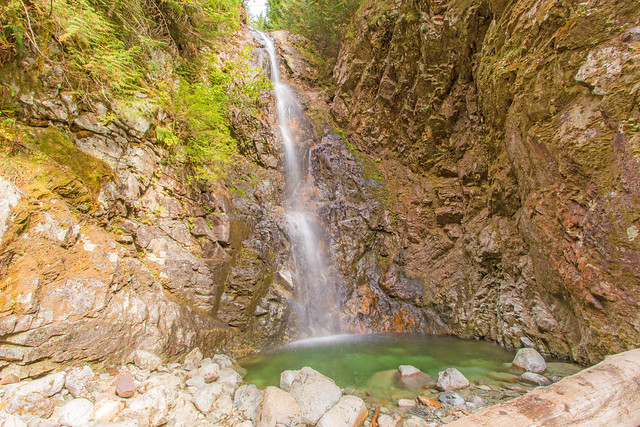
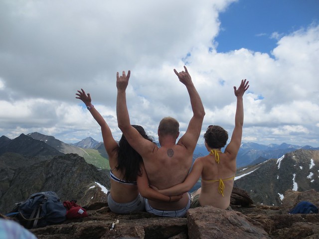
Andy G. on Zoa Peak:
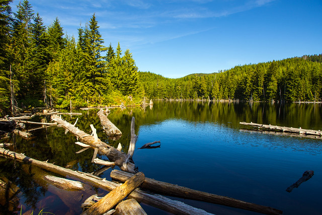
“A lovely mid-week excursion on a fine trail, this hike was nicer than I remembered. Bob and Tec joined me to meander our way up to the summit at a leisurely pace. As we got back to the car we decided to head in to Falls Lake to check it out – pleasant enough though very windy, it added less than half an hour to our trip. We were finished within 5 hours.

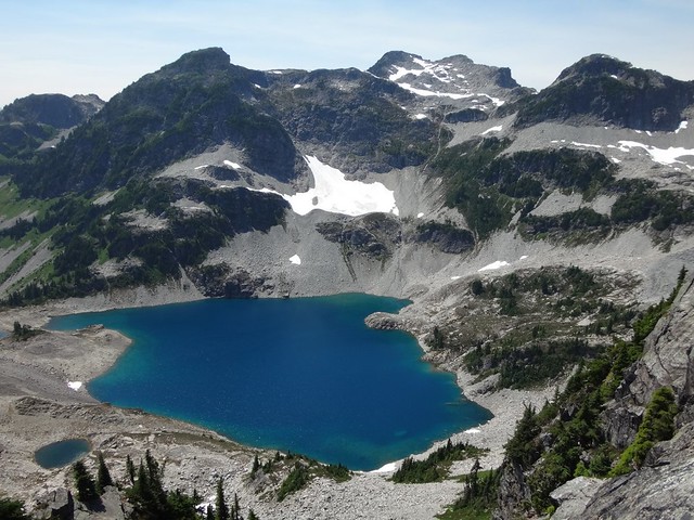
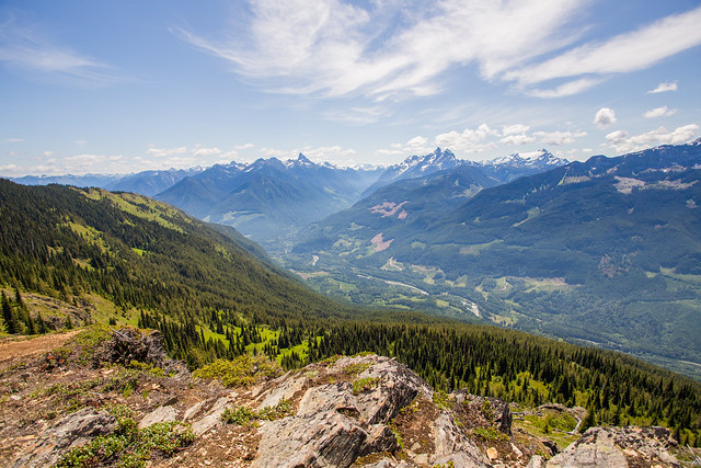
The trail was in good condition, though still a little wet at higher elevations where some snow remains. In places the trail is a small running stream, but perfectly manageable with hiking boots. There are a couple of excellent rocks for lunch spots with a great view of Alpaca, Vicuna and Guanaco.

Thankfully there were far fewer bugs than on my last visit a couple of years ago – I got only 3 bites compared with 120 last time! It was quite breezy, which seemed to keep them at bay.

Plenty of flowers out, but I think the best is yet to come. Glacier lilies are probably at peak bloom near the summit (a bit beyond the obvious viewpoint); they’re well past it on the open southerly slopes. Other flowers include (deep breath!): paintbrush, lupine, orange agoseris, valerian, arnica (at least 2 species), columbine, wild strawberry, buttercups, cinquefoil, thistle, marsh marigolds, globeflower, western anemone, rosy twistedstalk, queen’s cup, green bog orchid, phlox, spring beauty, meadowrue, larkspur and a columbia lily or two.

No animal sightings but we did find what we thought was mountain goat wool snagged on the heather, and saw a foot hoof-prints in the mud. The wool was incredibly soft and fine.

Thanks to Bob and Tec for a great day out. Photos from Bob and myself are up on Flickr.”

Zoa Peak, 11 Jun 2015

Elk-Thurston, 5 Jun 2015

Bob H. on Elk-Thurston:
“Back to Chilliwack for another classic hike. Today was the first day of a ‘heat wave’, so I thought it would be good to get out before the temps were supposed to rise on the weekend. It’s also nice to do this hike on Friday and beat the masses. On the way up, our group of 3 only saw one other hiker – a fast pregnant woman! She kicked our butts up there. We would eventually meet more people on the traverse back. There are amazing views of the Fraser Valley, the Chilliwack River Valley, Slesse Creek Valley and many local mountains. Temps were mid 20s in the alpine environment, but dipped to a more refreshing temperature in the forest. As there are long stretches in the sun, we did get plenty of sun. The alpine flowers were in bloom and the colours (red, orange, blue, violet, white, yellow) were amazing. We returned to a hot car and the temperature was high 20s.”

Chilliwack River Valley