Tag Archives: 4-day

Cape Scott, 1 Aug 2015

Andrew W. at Cape Scott:
“Six hikers planned to hike in Cape Scott Provincial Park on the August long weekend. Planning was a breeze, meals were arranged, group gear sorted and carpool and tent space for all confirmed.

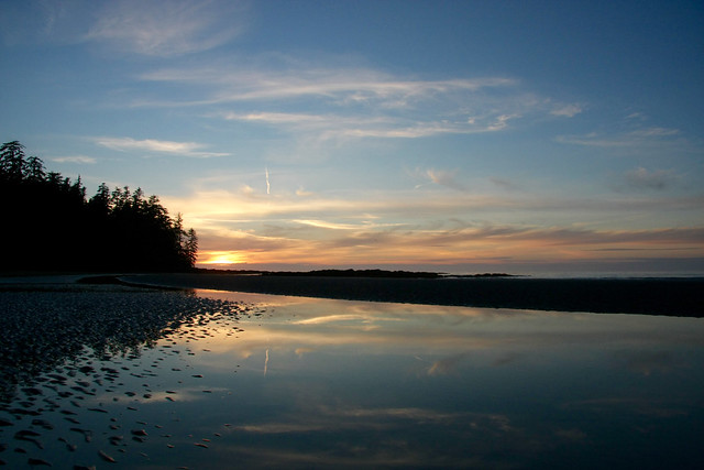
The Cape Scott Trail itself was very dry (a far contrast from the mud that Cape Scott is famous for) and the beaches all so sandy and beautiful. The weather was incredible with only a little bit of rain in the morning while we were safe in our tents. Surprisingly the trail was not very busy at all nor were the campgrounds. It was cooler temperature wise than in Vancouver but still warm so everyone went for a swim a couple afternoons to cool off and relax the muscles. Sleeping with the sound of waves crashing on the beach made for restful nights.

Nels Bight was our campsite of choice for two nights with a day hike to the lighthouse part of our journey. We camped at San Josef Bay for our final night as to provide a change of scenery and a shorter hike out to the car before the long drive home.

Plenty of food was shared among all, including a buffet of freeze dried meals providing ample opportunity to sample!

Lots of wildlife was spotted, including but not limited to: black bears, humpback whales, eagles, squirrels, I’m likely forgetting one or two sightings, there were a lot!

A wonderful way to spend a long weekend with great company!”

Sunset

Lost Valley 07/08/10

Chris exploring the Lost Valley:
“The weather may not have been ideal and the bugs fairly bad but we had a nice surprise which more than balanced this trip. With no signups, Cara and I were free to join a WCWC trail building trip that was, coincidentally, also going up the Wade Creek trail. Both the Haylmore FSR and the various Wade Creek roads are in excellent-to-decent 2wd condition and it’s possible to park within 1 km of the bridge over the creek. The trail is steep with an average grade of at least 15% and sticking to the ridge crest even when it doesn’t seem like a good idea. There’s some blowdown around the mid-point of the route but it’s well flagged. The WCWC is improving the trail by adding switchbacks when needed. The final stretch side-hills above steep slopes. The trail fades just below the lakes near the pass. With a bit of trail-building thrown in, we got to the lakes in about 5.5 hours. From the pass, we wandered ridges and meadows to reach deep into Lost Valley to its headwaters. You need to pick your ridge ascents and descents carefully. The lower meadows were lush with plants to our shoulders at times and footing was tricky because we couldn’t see our feet. Along with more ptarmigan and pika encounters, the highlight of the trip was the multiple wolf sightings we made (3 out of 4 days were wolf days) including watching a litter of pups play in a meadow for an hour or so.”

McGillivray Ridge 31/07/10

Chris on McGillivray Ridge:
“Cam, Cara and I spent 4 days on and around McGillivray Ridge on the edge of the Bendor Range with a mix of thunderstorms and smoke haze. Smoke kept the big animals away but we saw many ptarmigan families and marmots and a few pikas. The Hurley is in rough shape (washboarding and exposed rocks) but still 2wd. The East Hurley to Bralorne and the Kingdom Lake FSR are also both 2wd (and in nicer condition). We parked at the start of the McGillivray Pass road and hiked up. The alders at the start of the road are growing in again but it’s still easy to maintain hiking speed. There’s a few blowdowns on the road as well. We left the road for the high trail and found that, once you hit the meadows, the trail is hard to follow due to non-use and I was working off memory most of the time. We camped on the ridge near where the trail crosses over and used melting snow fields for water. There’s still lots of snow as we found on the second day when we continued along the ridge: at one point we encountered an 8-m-high drift. We found and packed out some old garbage including a leg-hold trap embedded in the tundra. We made a try for Whitecap Mt on our third day by following the horse trail down into Connel Creek. This part of the trail is in better shape but still disappears in lush meadows. We passed the Chilcotin Holidays cabin (in poor shape because there’s no door to keep wildlife out). The meadows beyond were the lushest I’ve ever seen – up to our waists in flowers and couldn’t see our feet. There were remnants of the trail heading up a creek to the west of Whitecap but too hard to follow. We ran out of time with 400+m still to go but with the steep part of the climb (40 degree slopes) done. On our last day, we bypassed McGillivray Mt and headed NW along the ridge – much narrower than the eastern half before dropping down, sidehilling around Royal Peak and down the ridge to the Piebiter roads. Most of these roads had been cleared for ATVs perhaps last year but those that aren’t are slide alder hell. Crossing Piebiter Creek (knee-height), we checked out the old Piebiter cabin (sturdy but in need of a good clean-out) before heading down to the car again.”

Graveyard Valley 01/07/10

Chris in Graveyard Valley (southern Chilcotins):
“Getting to the trailhead for this hike can be a challenge. We made it in a slightly lifted 4wd Tracker with AT tires. 2wds will find the going ok until some dried mud flows on the descent to Tyaughton Creek campsite – still doable but you might scrap. If you get past a waterbar near the top of a hill about 500 m north of the campsite, you’ll be able to drive to at least 13.3 km past the campsite. Beyond this point the puddles get bigger and 4wd with good tires are recommended (later in the year, you might be able to push it for another couple km to the top of the big hill). We took the Relay Creek trail to the cabin then went up the Little Paradise Creek trail, over the pass to Graveyard and down to the large meadow where the main creek is. All the trails were frequently boggy with snowmelt and there were frequent creek crossings (many unavoidable). We had 2 nights of sub-zero temperatures and a mixed bag of weather – some rain, some snow, some hail and some sun. We explored many of the ridges around Graveyard including Elbow Mtn (climbing to 2450 m barely touching snow). Almost ran into a grizzly in Little Paradise (there’s also a large one in Relay – saw some enormous prints), heard some wolves calling and saw lots of deer and marmots. On the way out, we travelled down to Graveyard Cabin (which is showing it’s age – I’d opt for a tent given the choice) and back along the Relay Creek trail.”

Juan de Fuca Trail 21/05/10

Stephen P. on the Juan de Fuca Trail:
“Don’t Juan de Leave, the Juan de Fuca Trail – 2010 May Long Weekend…

Backpacks filled. Cars gassed. Ferries reserved. Off we go. Forty-seven km muddy trudging, suspension bridges, waterfalls, although more beach hiking would be nice. Chilly nights, many water sources, abundant gorgeous pictures, and cool ocean winds to cool you off while hiking. Trail descriptions claim 25 m elevation gain, this occurs over, and over, and over, again. I found this much easier on my beat up knees than the usual alpine hike, as the multiple descents were very short.

We avoided car accessible campsites to stay away from tent city high schoolers, our daily hike distances varied accordingly: 2, 19, 12 and 14 km.

Great campfires, unfortunate broken promises of sunrise yoga, laughter that echoed across the cool waters of Juan de Fuca Strait, on the fly doggie bag MacGyvered gaiters. Thanks to J, D, R, M, I-S, V, and S for making a memorable trip.”