Yearly Archives: 2010

Slollicum Peak 12/06/10

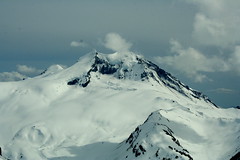
Erez atop Slollicum Peak:
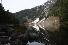
“This was my third attempt at Slollicum. The other two times were in the middle of winter. The trail was much easier to find when most of the snow has melted at lower elevation. Make sure you don’t miss the flagged marked right-turn just after entering the forest after about 800 m along the Harrison East FSR like I did. When I was there before, we couldn’t find a section of the trail (just when you cross the first gully), and we assumed that it was due to a land-slide. Not true. The trail actually leads across the gully. Consistent snow started at around 1300 m, where the markers seemed to taper-off. But from that point it was pretty obvious how to climb to the ridge, and then take a left to reach the peaks. Snowshoes were not needed as the snow was pretty packed. The second (true) summit is worth the extra walk as it is more open and provides very nice 360 degree view. The huge Harrison lake is spread on the west, and Mt. Baker is prominent in the south. In the east I saw little Slollicum lake which was frozen.

This is a very nice and not difficult summer hike. If you like Harvey/Brunswick/the lions, you’ll enjoy seeing similar views in a new location.”

Brew Hut 04/06/10

Robert D. at Brew Hut:
“The somewhat unusual timing of a snow shoe trip (Friday evening to Saturday afternoon) proved too good an opportunity for 10 of us to miss. So Paige, Jennifer, Mazy, Robert, Iain, Allan, Mike, Rebeka, Scott and Andrew drove to the trail head on the Roe Creek FSR to follow the winter route. Headlamps and rain gear were used almost from the outset and snow was underfoot pretty quickly too. The trail was surprisingly easy to follow at night in the forested section, the reflective markers easily visible with our headlamps. Once we got up to the alpine, however, a GPS was used (and well needed!) to find the hut. Despite there being plenty of snow underfoot the weather was surprisingly warm. We arrived at the hut about 2 am. Many thanks to those who provided some well-deserved night caps!

Saturday morning was spent exploring around the hut. Most of us hiked back to the cars in as little as 2 hours. The hut itself is small but bright and well built. All in all it was a pleasure to stay there. Always best to check the availability first on
https://www.ubc-voc.com/wiki/VOC_Hut_Registration.”

Brew Mountain

Lynn Peak 24/05/10

Rich enjoying a nice cup of tea on Lynn Peak:
“Surprisingly, even with a short notice same day callout to join me for a cup of tea on Lynn peak on Victoria Day, I got 4 other wanderees to come along; Monika, Amir, Lulia and Tyler. And excellent company they were. None of them had been up Lynn before so I was able to play field guide leader and introduce them to the finer aspects of the Lynn Peak trail. The conditions at the “top” were cool but totally clear and the views were quite satisfying at all 4 lookouts. Monika brought along an especially good Pu-er tea and shared it around. Also some chocolate bars from Meinhardts. Watch out for that girl, she likes her high quality foods! We parted ways and said our goodbyes where the trail joins back to the Cedar Mills loop trail. A good time was had by all and there was talk of hikes to come. Happy trails.”

Wild Side Trail 22/05/10

Paige on the Wild Side Trail:
“Ten of us hiked the Wild Side Trail, which is a little known hike across Flores Island. It requires a water taxi ride from Tofino to Ahousaht, which is a First Nations town on Flores. The hike to Cow Bay is only 10 km through the forest with a good amount of beach walking for the tired or lazy. Not many people know about the hike, and you’re almost guaranteed to see bald eagles, otters, seals, sea lions and possibly bears or wolves.

It’s definitely worth making the trek out that way – the sunset at Cow Bay is gorgeous (see Chris M’s photo in the Wanderung Flickr Group) and we watched whales only a few feet from us while we collected mussels to eat at the campfire. It’s also possible to kayak there from Tofino.”

Cow Bay

Pender Island 21/05/10

Michelle on a cycle tour of Pender Island:
“Despite some on the spot re-planning courtesy BC Ferries and Parks Canada, eight of us had a very enjoyable trip cycle touring, hiking and playing tourist on both North and South Pender Island. Three of us stayed at Centennial Friday before meeting up with the rest of the group who arrived Saturday morning. The Saturday market was indeed full of delicious and creative items and a worth while stop. Our private peninsula camp at Welcome Bay Farms was a lovely setting for our base camp for the remainder of the trip. Local Island hospitality and great company made this trip complete!”

Juan de Fuca Trail 21/05/10

Stephen P. on the Juan de Fuca Trail:
“Don’t Juan de Leave, the Juan de Fuca Trail – 2010 May Long Weekend…

Backpacks filled. Cars gassed. Ferries reserved. Off we go. Forty-seven km muddy trudging, suspension bridges, waterfalls, although more beach hiking would be nice. Chilly nights, many water sources, abundant gorgeous pictures, and cool ocean winds to cool you off while hiking. Trail descriptions claim 25 m elevation gain, this occurs over, and over, and over, again. I found this much easier on my beat up knees than the usual alpine hike, as the multiple descents were very short.

We avoided car accessible campsites to stay away from tent city high schoolers, our daily hike distances varied accordingly: 2, 19, 12 and 14 km.

Great campfires, unfortunate broken promises of sunrise yoga, laughter that echoed across the cool waters of Juan de Fuca Strait, on the fly doggie bag MacGyvered gaiters. Thanks to J, D, R, M, I-S, V, and S for making a memorable trip.”

High Falls Creek, 15 May 2010

Su-Laine at High Falls Creek:
“Eight of us enjoyed a mostly-sunny day hiking and scrambling up the steep and varied trail to the High Falls Creek viewpoint, and walking along the gentle logging road back down. The trail was in great shape with no snow and no difficulties with creek crossings. Note that the driving directions in ‘103 Hikes’ 5th edition are less than ideal.”

Mt Price 15/05/10

Ben on Mt Price:
“Four hikers began from the parking area at 8:30 am. The lower lakes were beginning to thaw but we still managed to make use of the winter route by staying along the shores. Three hours from the car we arrived at the lake and took a short break to snap some pictures, eat some lunch, and trade crampons for snowshoes. Beyond the lake the snow was in good condition and the GPS kept us right on track. The final 300+ metres were gained on a steep snow slope leading up a rib between Price and Clinker. Once atop, the grand views south to Garibaldi opened up before us. We paused here before crossing a small col and to reach the summit of Mount Price at 3:00 pm. With great weather and views in all directions, the group spent nearly an hour enjoying the broad summit. The return trip to the lake took only half the time, but then we had the long descent back to the car.”

Mount Price 15.05.2010 152

Lower Stein Valley 15/05/10

Steve in the Lower Stein Valley:
“A well matched and fun team of 6 hikers went up to Skihist provincial park for a night and embarked up the Stein trail (to the suspension bridge) the next day. The roaring Stein River was at our side for most of the trip and the trail was not too challenging to be carrying an overnight pack (even the Devil’s Staircase was short enough to present no problems). It felt like an August hike! What a treat to get 25 C+, dry weather in mid-May.

We stayed at the Earl’s Cabin campsite but I have to say that the build-up over the years I’d heard about Stein was not fully warranted. It was nice, but nothing to put it on the world stage like it seems to be (similar to the WCT). However, there are three reasons that you might want to add this to your list:

  • Native pictographs – I’ve never seen these on any trail before (very cool!)
  • extend your season – when nothing else is doable, you can hike this trail in warmth much earlier (sometimes April)
  • warm up to backpack season

IMG_0747

Hector Ferguson Lake 15/05/10

Erez at Hector Ferguson Lake:
“This was a 2-day camping trip. Michele and I started hiking around 10:30. The first ~11 km of the trail are very well marked and we had no trouble getting to the Gold creek crossing. There are a few places where one needs to cross very minor creeks, but that is easily doable with no need to take the boots off. We set up camp at the sandy patches on the east side of Gold Creek, had lunch, and by 15:00 we continued to the lake. Gold Creek is now passable, with two branches to cross. The first crossing is wider but shallower and with no strong current. The second one is deeper and has a pretty strong current but with a stick and some careful stepping is not a problem. The level of the water was thigh-deep at the deepest place. After the creek the trail is more overgrown, but still pretty easy to follow. Very close to the lake there is a land slide and the trail is harder to find. You need to hike through the dry creek bed-rock a little up the slide and then veer left following the orange markers into the forest (thanks to Michele we added markers so this should be pretty obvious now). From other trip reports I read, I believe this is the place other people left the trail and got stuck. The marked trail does lead all the way to the lake. We stayed there for 1/2 an hour and hiked back to the camp for some nice dinner. This was an awesome trip.”

IMG_4833