Yearly Archives: 2011

Garibaldi Lake 25/08/11

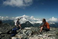
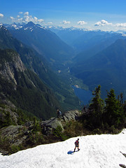
Stuart at Garibaldi Lake:
“Four of us set off heading up the 6+ km of switchbacks in 1½ hours. After a brief rest at the junction the group headed left and 20 minutes later arrived at Taylor Meadows. The sides of the trails are covered with alpine flowers and definitely worth adding the additional 2 km. Shortly later you have your first glimpse of Black Tusk, don’t forget to check the view behind you once in a while. Continuing along the path you eventually come to the junction for Garibaldi Lake, take a right heading down the switchbacks until you cross the bridge. The trail becomes fun and interesting as at some points you tip toe across rocks breaking the water’s surface to continue around the lake. You should explore the entire trail around the lake as besides the views of the glacier there are some interesting points. Firstly there is a small island accessible from the trail where there are some Indian Paintbrush plants. At the trail end by the ranger’s dock is not the best place to have lunch. The Whisky Jacks create a scene reminiscent of Alfred Hitchcock’s “The Birds”, it was quite bizarre. We headed back the direct route returning 9 hours later.”

IMG_0388

Williamson Lake 24/08/11

Steve at Williamson Lake:
“After years of worrying about the “gate” on the road to this trail, I finally was told it would never be shut again so decided to do it. However, a different logging company blocked the access at Chilliwack Lake road… Five of us piled in Steve C’s truck and suffered a long re-route and late start as a result. The trail was steep and not without problems in a) finding the start, and b) crossing a few scary scree slopes. All told it’s a short trail, but it is SO steep that it just did not feel that way and took us over 2 hours up. The payoffs were amazing: wildflowers, the frozen lake itself and surrounding slopes (including a brown bear). Be aware, it IS wildflower season in Chilliwack, so get out there, but if you have a 4X4 AND a fear of exposed heights, head to nearby Mt. Cheam for something less stressful.”

Mt Gardner 21/08/11

Cindy on Mt Gardner
“Six of us made it out to Bowen Island on Sunday. We parked at the trailhead instead of doing the walk from the ferry terminal. If there is a large group, you may want to get the BC Ferries Experience Card. You get quite a large discount on this route.

The distance markers referenced in “103 Hikes” are no longer visible and the side road up to the gate head is now called Hikers Trail Road, not Bowen Pit Rd. The intersections of the different trails do have clear signs, but I would recommend spending some time at the large map near the entrance and deciding what route you want to take before heading up. The trails themselves are typically well marked, but there are a few notable gaps where you might have to do some searching to find the next marker.

We were spoiled with views at the top, with not one but two different platforms on which to sit and enjoy the scenery. A wonderful hike, with wonderful people!”

Mt Harvey 20/08/11

Hurrian on Mt Harvey:
“Eight speedy hikers headed up Mount Harvey on Saturday and were treated to breathtaking views of the Lions. There was only just enough snow in one section at the top for me to have a good wipeout by trying to boot ski down a snowy patch. The trail is quite steep to the ridge but is shaded by the trees so it wasn’t terribly hot until we got out onto the ridge. We summited in about 3.5 hours and got to have a spectacular view while eating lunch and snapping shots. Not many other people on the trail except for a pair of pot-smoking middle-aged men. All in all a good hike with good company.”

Williams Ridge 15/08/11

Dan R. on Wiliams Ridge:
“Ronald and I were the only ones on the trail until the end of the day. From centre of Vancouver, less than a 2-hour drive both ways. I measured 32 km on my odometer to the trailhead from the turn onto the Chilliwack Lake road. Hike took 3 hours each way, not including breaks. Ridge is about halfway. Trail is less steep as you gain altitude. A few trees down, nothing major. Mild brush growing in, but it got me pretty wet (rained overnight). No snow or mud. No sign of bears. Lots of bugs, except at knoll. Trail peters out at first knoll. Recommend going at least to the 2nd/3rd treeless knoll. If you see the unmarked intersection on the steep part, go left. Unmarked intersection as you gain ridge, go right. Unmarked intersection further along ridge, go left.”

Williams Peak 13/08/11

Eric on Williams Peak:
“Four of us decided to have a go at Williams Peak on Saturday. It is about 1:45 drive from Vancouver and looks very impressive. The parking is 32 km from the turn off to the Chilliwack River Road. The trail is incredibly steep and gruelling. (Think a couple grouse grinds.) Luckily it is in the shade. The well travelled trail kind of peters out in a bowl under the massive pyramid peak. The summit can be gained from a gully hiding behind the right flank of the mountain. We saw a mother grouse with two chicks, also out for a Saturday hike. The entire hike can be made without walking on much snow. Great conversation ensued once the peak was conquered. Milkshakes at white spot followed. What an exhausting and throughoutly satisfying day. Thanks guys.”

Williams Peak 13.08.2011 062

Tricouni Peak 07/08/11

Chris M. on Tricouni Peak
“Six of us went up to Tricouni Peak. The final part of the road was rough on our two 4wds. Trail was certainly muddy to start but we were soon on snow from before the first lake. All us of then went fairly straight up the somewhat steep snow slopes. Erica, Ian & his dog waited near the sub-summit while the four of us – Glenn, Brad, Scott and myself – went up on the top. Bluebird day. The much-sliding down might have been the highlight!”

Hope Mtn 07/08/11

Steve on Hope Mountain:
“Thanks to a great response from 4×4 drivers, 8 of us tackled the trail known mostly for views of the town of Hope (from straight above). Rob and Rob managed the road and got us there safely. The trail was very “Indiana Jones” (overgrown) for much of the way and there were 2 very minor scrambles, and only patches of snow were left. The bushwhacking aspect of this really slowed us down and hike time exceed even my padded estimates. It took us close to 7 hours on trail (some books estimate 5, Club Tread says 6). It was a long day ending at the Wildcat Grill near Harrison, but the weather was great, and surrounding views impressive (though hazy). Word to the wise – never sit ON the cairns at the peak or anywhere else, you never know what the engineering skills are of the person that built it…”

Hope Mountain, Aug 2011

Lynn Peak 06/08/11

Cindy on Lynn Peak:
“Three of us hiked to Lynn Peak, leaving the trailhead at 11am. The parking lot was quite crowded by that time, but the trail itself wasn’t too busy. The trail was dry with only a few slightly muddy patches. If you keep moving the flies aren’t that bad, and the breeze at the viewpoints is enough to keep the worst of the mosquitoes away. As we reached the top, the sun broke through the clouds giving us a great view back towards Vancouver.”

Williams Ridge 06/08/11

Hurrian on Williams Ridge:
“Three of us made it to Williams Ridge. 103 Hikes is a little incorrect about the trailhead. It caused us to look for the trailhead for two hours before the start of the hike. The start is around 30 km down Chilliwack Lake Road rather than the 34.5 it claims. Look for a sign that says “Wms Ridge Trail” that is visible from the road. It gets steep very quickly, ascending 1000 metres in about 3 km or so. After that you hit a ridge that has some stunning views of local mountains. Surprisingly there was very little snow on the trail. Only a bit in the final sections. Definitely recommended hike as long as it’s clear enough for a view. The descent is not as rough on the knees as it could be since much of the top section of the trail is padded with tree mulch.”