
Ahmad on Blackcomb Peak:
“Our hike started from Lot #6 and on the ski runs. We discovered that hiking on ski runs is not a bad idea. We collected over $10 worth of coins. After we reached Blackcomb lodge, which was closed, we hiked to Seven-Heaven Chair to get on the ridge that leads to Blackcomb Peak. The ridge is rugged and rocky. I found that there were two tricky sections and one of them was moderately exposed. Four of us summited after a 6 hour ascent. I found the views from the peak are superior to those from the Musical Bumps. On the way down, we took a different route. We headed down to Spearhead’s col, on to Disease pass, and then down to Blackcomb Lake. Many loose rocks especially on the way to Spearhead’s col. The whole trip took 10 hours. Special thanks to Chris for providing me important information of this scramble.”
Yearly Archives: 2008
Cypress Peak, 1 Sep 2008
Tim on Cypress Peak:
“Tim and Firas scrambled Cypress Peak (2,083 m) on Monday 1st Sept. This is a fairly easy scramble to a pointy-looking peak just north of Tricouni Peak (between the Squamish and Cheakamus Valleys). The road access is excellent (2wd all the way to the trailhead) although the updated info from Cairn Publishing was also helpful (https://www.cairnpublishing.com/updates/cypress_road_update.htm). The trailhead is easy to find. The route is simple and relatively short. One moderately difficult step on the north ridge makes it interesting. Climbing helmets are essential, however an axe is not required at this time of year since minimum snow was encountered. Also, Roe Creek is easy to cross at this time of year. It took us about 3.5 hours to reach the summit, providing excellent views of Tricouni Peak, Mount Brew and Mount Fee. We were very lucky with the weather because the cloud lifted at about 11 am.”

Brandywine Meadows 01/09/08
Su-Laine at Brandywine Meadows:
“After three cancellations, five of us piled into one car and had a super afternoon at Brandywine Meadows near Whistler. Thanks Ahmad for the new driving directions. Don’t let the short (6 km) distance and the word “meadows” make you think this is an easy hike – it was the muckiest trail I’ve done in a long time (as one person put it, it became no longer about mud in his socks, but socks in his mud), and steep with lots of fallen trees and some confusing trail marking that caused our group to be separated for about an hour on the return. The meadows at the top, with mountains in the background, are a very special place though and this was a trip to remember. Flowers were blooming, but starting to die off – better get there soon if you want to see them this year. We met up with Carole’s group and had lunch together. “

Mt. Seymour 01/09/08
Carollyne at Mt. Seymour Norvan Falls:
“Unfortunately, sometimes weather doesn’t co-operate, and today’s plan to hike Seymour was one of those occasions. Seven of us eagerly went up to Seymour, hoping that somehow the cloaked North Shore would reveal itself when we got there, but the fog was so dense, the end half of the parking lot was invisible and the buildings disappeared too. We all agreed to hike to Norvan Falls instead, and had a great hike with lunch at the falls, and soaked up the sun at Third Debris Chute beach on the return trip. The water levels in all the creeks are now quite low, making it an easy hike, although muddy at times. We met two backpackers on an early return from Lynn Lake – due to the weather. Momentarily, some of us thought about trying Seymour again this afternoon, but the pleasant sound of the Lynn Creek washed that idea away.”
Williams Peak 01/09/08
Ahmad at Williams Peak:
“A blanket of grass was the way to the summit. It was not exposed and wasn’t much of a scramble. All seven of us summited. We did our ascent through fairly hard weather: rain, hail, and even snow. The weather improved later on but we hardly had any views. The trail to Williams Ridge is steep and fairly well-marked. The last kilometre to the summit is rough and rocky and gets steep nearby the summit. There are sporadic cairns and ribbons on the way but not many. If you go around the trees clockwise at elevation 1860 m to get up on the south-west ridge of the summit you will hardly encounter any scramble. The way to the summit is a well-defined, fairly wide gully covered by grass on the south face. Many loose rocks so helmets are necessary. We didn’t see anyone on the trail and saw recent bear scat on the ridge. Our whole trip took 11:05 hours. Special thanks to Tim Gage for providing me important information about the trail.”

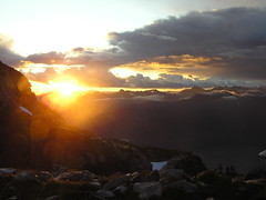
Golden Ears 31/08/08
Astrid M. at Golden Ears:
“It took our group 7 hours to reach the small emergency shelter. Recent wet weather created several muddy patches and made the roots and rocks slippery. One bridge over a creek is broken and slanting down southwards (hold onto the north handrail). A good part of the lower trail is more a creek bed than a trail, meaning lots of loose rocks. After setting up our tents at around 5:30 pm we heard distant thunder. Three of us decided to try to summit before the storm moved in but got turned around by hail and lightning. Luckily the sky cleared and we were treated to one of the most beautiful sunsets I have ever seen. The next morning we awoke in a cloud. We waited until 11 am to see if the sky would clear, but visibility stayed poor so that the summit was not possible. We returned to the parking lot in 6 hours back.”
Stein Valley mini traverse 30/08/08
Merewyn in the Stein Valley:
“Pictographs, cable cars, unlogged old growth forests, a beautiful clear river – the Stein Valley has it all and more! Andy, Maria, Christian, and I spent a wonderful week traversing the Stein from Blowdown Pass to Lytton. The trip started out with intense snow flurries at Blowdown but once we got over the pass and down into the valley we had great weather. We saw no large wildlife but we did see lots of squirrels, mice, ant lions, lizards, and snakes. In fact, we saw as many snakes as we saw people – once we left the Pass, we only saw 8 other people and had every single campsite to ourselves. The section between Blowdown and the Stein is obviously very under-traveled as we saw no other hikers and counted 76 trees blocking the trail within an 8 km stretch. The main Stein trail was infinitely more maintained. An unforgettable area!”
![Stein Valley - Thurs, 04.Sep [Day 6]](https://farm4.static.flickr.com/3255/2836686687_f580a76934_m.jpg)
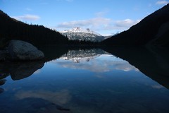
Joffre Lakes 30/08/08
Anne at Joffre Lakes:
“Three of us took off on the Labour Day weekend for an overnighter trip to Joffre Lakes. The last part of the drive from Pemberton to Joffre Lakes Park was quite painful because we had 3 (!) RVs in front of us – so it seemed to take forever to get to the parking at the trail head. Once we started hiking we were accompanied by light rain most of the time; but it wasn’t too bad because the sun was poking through at the same time. At the second lake we had a pretty dramatic encounter: Kim got attacked by a Whisky Jack and had to give up an entire chocolate bar to the vicious bird! We still made it in pretty good time up to the Upper Lake and arrived early enough to find great camping spots right on the water. By the end of the day almost all camping spots were taken – it sure is a popular destination for a weekend. We had all sort of weather; sunshine, rain and hail. Unfortunately there was not much of evening entertainment possible because it just kept raining and hailing in the evening and it was REALLY cold. (Lesson learned: do not forget your toque!) The next day we woke up to great sunshine, after breakfast we set out to explore the glacier – well, actually we only wanted to walk up a bit on the ridge but somehow ended up right at the glacier. The cracking noise of the glacier and the terrain was a bit intimidating, but we got some great views. During the day the clouds moved in and out, on our way down back to the car we had some more rain. The trail was by then really muddy, so gaiters sure came in handy. Once we got back into the car and started driving back towards Pemberton we encountered a bear right on the street. We finished off a great weekend with a steak in Whistler before heading back to Vancouver.”
Athelney Pass 30/08/08
Chris at Athelney Pass/Salal Creek:
“Attrition due to injuries and work commitments whittled our group down to just 2 but off we went anyway. The Lillooet River FSR is in good 2wd condition all the way to the Salal Creek Road. A creek was flowing over the road at 45.5 km which is probably doable by a confident driver in a 2wd with average clearance but depends on the time of year (earlier = higher water level). The hill beyond had a bumpy bit at the start but was good after that. At the top of the hill is the unmarked Salal Creek Road on the right (47.8 km). Most of the traffic on this road takes a right fork at 1.1 km to go to a mine – the route to the trail is straight over a shallow berm (may require high clearance). Two-wheel-drive traffic will be halted by the heavy rutting caused by water runoff at 1.3 km. We turn left at 5.3 km (straight leads to a new cut) and arrived at the trailhead at 6.0 km. The trail started at the far (north) end of the cut and is flagged by orange and pink flags (some initial confusion due to 2 parallel sets of flagging 10m apart – the best set is the uphill ones). A distinct footpath is rare but the flagging was good even in dense slide paths. Half an hour later we emerged on the gravel flats next to the creek. Whenever the creek hugged the east bank, flags led up into the forest to bypass the section (keep an eye peeled for them). There was one unflagged section of alder travel (100 m but felt much longer). Nearing the glaciers and after the recent rockslide, a faint footpath appeared close to the creek but disappeared after the first side-creek crossing. The 2 creek crossings are unbridged but we rock-hopped over them after scouting for a good crossing point. After that, the route traveled along a glacial moraine until it got too eroded and knife-edgy and we were forced down to the creek again. Much rock travel took us to the volcanic flats from where it was less than an hour to the collapsed cabin at the pass. Over the next couple days, it snowed, our boots froze solid, we visited ice caves at the toe of Athelstan Glacier, travelled down the boggy McPharlon Creek and climbed the Elephant.”
High Falls Creek 30/08/08
Pablo at High Falls Creek:
“First attempt Sea to Sky was closed. Second attempt nobody signed up. Third attempt six of us, following the instructions, we tried again. After the bridge at the power plant we founded a trail with the orange tape that matched the description. We started hiking up what seemed a trail for about 400 m waiting to find a chain after 30 min. We ended up scrambling on animal trails so we took a group decision to go down. We reached the cars around 2 pm and we had lunch. After that we decided to go further on the road and found the real trail. So it’s the second bridge after the power plant, not the first one. Fourth attempt. We decided to try again, the hike was as described in the book, steep, chains, close to the ridge, hard, but compared to our first attempt it seemed easy. We couldn’t find the logging road to go down, so at 5 pm we decided to go back from were we came up.”
