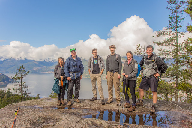
Colleen C. at Eagle Bluffs:
“Glorious day to be on a mountain – spring is certainly upon us!
The air was cool through the forest on the way up, keeping the sweat at bay, but was balmy on top. No biting bugs out yet so we basked comfortably in the sun enjoying the views of the tankers, islands, ferries, and several eagles & ravens gliding in the thermals. Lots of grouse are out, and we saw a snail!
There were only tiny patches of snow in a few sheltered spots at the bluffs (just enough for snowballs but you had to work at it). We met one person who had come from the Cypress side, she reported little snow and just wore boots. That said, there are recent reports of heavy snow on other North Shore peaks, so do your best to get current info and be prepared. Spring can be capricious!
This was my first time doing this hike by transit and it worked out well. Take the 250 or 257 to the overpass just before descending into Horseshoe Bay. From there it’s a careful crossing of Horseshoe Bay Dr and short walk back to the Black Mountain trailhead.”