All posts by admin

Mt Harvey 18/02/10

Erez on Mt Harvey:
“After deciding to change the destination from Slollicum Peak to Mt. Harvey, due to higher avalanche risk in Slollicum, Graz, Ben, Scot and I met up at 8:00 and drove to Lions Bay to hike up Mt. Harvey. The trail is well marked, but one needs to take care to find the exit from the logging road to the actual trail which is easily missed. The exit is on the left of the logging road just as the road narrows down and become more overgrown, it has a board on which the word “Harvey” is engraved. Snow started at about 1000 m, but this is only approximate as I didn’t check my altimeter. The snow was pretty hard and icy, crampons would be ideal, snow shoes with a good grip have also worked for me, but were not as comfortable. The snow on the ridge is a little softer but still does not really require snow-shoes. The weather was great and we had some beautiful views of the Lions, Brunswick, Howe Sound, Vancouver, and even Mt. Baker in the distance. It was a good trip with good company.”

Mt. Harvey

Croker Lookout 13/02/10

Su-Laine at Croker Lookout:
“A fine Saturday with good company on the lush green trail to Croker Lookout. Stream crossings made life interesting. Hiking poles were helpful, as were umbrellas. Traffic was a non-issue and the trails were practically empty. Lougheed Mall’s bus loop was a good meeting spot, especially as it was close to the Insadong Korean restaurant where some of us enjoyed a tasty post-hike dinner.”

Indian Arm from Crocker Lookout

Cheakamus Canyon 06/02/10

Michelle in Cheakamus Canyon:
“Green mountains and spandex-clad road cyclists cruising down the Sea to Sky, you know – just your typical winter scenery. The only signs of the impending WINTER Olympics were the Olympic Lane signs starting one block East of Kootenay Loop on Hastings St (FYI – may be a tad trickier than anticipated using this meet spot during the games), sign boards blinking about upcoming road restrictions and the two million metal pole lane dividers hiltied into the asphalt at every single set of curves in the road (basically the whole thing). Traffic was light, but lanes are narrow, and driving wasn’t super speedy. Neither was the hiking – we just ambled along the easy trail happily taking pictures all the while. An enjoyable spring like outing whose only hint of winter was the frosty wind that occasionally blasted through the canyon.”

Mt Seymour 06/02/10

Rob M. on an evening snowshoe to Mt Seymour:
“I had forgotten the appeal of an evening snowshoe where the visual hike is dimmed and conversation comes out suddenly from the dark. Without the big picture wrapping all around us we were kept in the moment of the snow beneath our feet. For the most part the snowpack was hiking boot enabled. With some aggressive and skilled toeing and heeling we made it to the first pump without incident. The view from Brockton Point was a nudge and carrot to carry on to the summit. The final push, while daunting at first, was approached with a spirited energy that paid off with an unlimited view of the city lighting up a low ceiling with a few starts twinkling through the canopy. The Seymour evening really lit up when two Wanderung newbies – Nadia and Shannon – offered up a warming beverage followed by sweet chestnuts and Eugene’s Belgium chocolates. With a soporific warm glow on, we floundered our way back to the parking lot. Trying to find a reasonable pub turned out to be another episode. The Raven’s Head was choc-a-bloc with wrestling fanatics. We caravaned through an industrial area around Arcteryx based on an old email someone read about a pub being in that neighbourhood.

After settling and tucking in we had a lively conversation about… silence.”

Seymour 2

Sunshine Coast 29/01/10

Christian at Roberts Creek and Porpoise Bay Park on the sunshine coast:
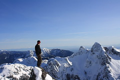
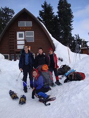
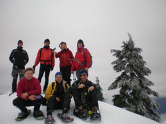
“A group of 4 adventurers arrived in Roberts Creek after dark. The roads were very dark and the signs were hard to read. Yet we still found the co-housing commons building on Emery Road. We attended the tail end of a show with the Tetrahedron Outdoor Club. The club members in general were much older and more guarded than we expected. Recreation areas in Tetrahedron Park seem to be a secret, closely guarded from the ears and eyes of us “Townsies”. John, from Surrey, was the social adventurer who started a conversation with smiling Marge. An ever smiling and wise old lady with a fantastic humour. She was very helpful in giving us directions and introduced us to a few club members. After informing others of our intentions, the worry-some looks on club member faces encouraged us to come up with a plan “B”. The road up to Mt Richardson is about as daring as the access road to Tetrahedron Park. There are a few ditches to cross that really require the use of a 4WD. Though, most of the roads are clear of snow this January, the roads are in the transition zone of freezing and are icy. A talkative man named Steve, surprisingly younger than us, gave us tons of advice and even drew up directions. He said going to Tetrahedron requires the use of crampons to walk through the transition area, and then thereafter with snow shoes – glorious powdered snow awaits. A shame that our upcoming Cypress 2010 Olympic events were not held there. 😛
Late in the night, we ventured for a nearby camping spot. We guerrilla camped at Roberts Creek picnic grounds. It was lightly raining all night, and we made good use of three tarps. With the two tents, we stayed really dry and slept well past sunrise. The ocean, the birds, the rain drops and the waves were relaxing for all of us. In the morning, the occasional dog walker made for some interesting doggie entertainment. We were paired up, so we got up at different times. As pairs, we walked along the stone & gravel beach for quite a ways. The stone beaches were quite pleasant and relaxing. Every community member we encountered was friendly and talkative. What a place to live! We returned, we packed up, and we made tea. With everything back in the car, we went to a Roberts Creek cafe – the Gem Top.

At the Gem, we had hot choco, cappuccino, cinnamon buns and gluten free treats. By half past noon, we left the cafe in search of easy walking trails on the logging roads nearby. Following the directions provided by Steve’s hand drawn map was a challenge. We encountered active logging on our preferred road on Saturday, so we turned back and took some other turns. We took a side road and passed what some could call a hippie camp. There from the car, we saw a large green camperized school bus, a teepee and a large yurt built upon on a giant wood deck.

A short drive up further, we stopped at a trail heading up into the bush – between the clear cuts. We followed the trail for 15 minutes until it grew over with dead-fall and disappeared. Instead of turning back, we followed an idyllic stream marked with surveyors tape for another hour. The stream seemed to be marked with tape to help maintain a buffer zone for the loggers. It was an interesting hike along the stream, around trees, deadfall, giant stumps and around natural obstacles. When we came out, we discovered we were hiking up a stream that belonged to the fabled long tailed frog.

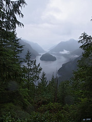
By late afternoon, a few were still eager for more hiking and exploration, so we headed over to Porpoise Bay campsite. It was quite a large campsite with many large group shelters. We stopped at the sandy beach and had an early dinner of roast beef and Tsatziki on a picnic table. Post dinner we walked along the trail to Anglers creek and heard a few animals drop or jump into into the fresh water creek as we approached. We envisioned returning to Porpoise Bay in the summer for glorious swimming at the sandy salt water beach and for other play in the calm & deep fresh waters of Anglers Creek. We were tempted to jump in right there into the crystal waters of the creek, yet we held off and returned to Vancouver happy and dry.”

Elfin Lakes 28/12/09

Carollyne at Elfin Lakes:
“Four of us headed off Monday morning on a trip with some surprises. I was quite worried about getting up the logging road in winter, but it was easy. The road up was easy to drive in a little car with snow tires – bare and frozen with some potholes, but not as many holes as on some summer trips. The 12 km winter snowshoe route was pleasant and uneventful, although the sky was overcast. Red Heather hut was warm for a break. Elfin Shelter was less than half full when we arrived just after 2 pm. Jeremy and Scott hiked about halfway up Columnar before light failed, while Su-Laine and I tootled around more casually. As the afternoon progressed, more and more skiers and snowshoers kept arriving at the hut, and we were glad we got our bunks early. Cards, wine, dinner and Jeremy’s excellent dice game made a really enjoyable evening. People kept arriving and we heard comments about how it was busier than on the lovely sunny weekend that had just passed. Everyone seemed to have had the same brilliant idea to avoid the Christmas weekend crowds, thus making a large weekday crowd, with someone sleeping on every patch of floor in the loft, and on all the picnic tables and benches downstairs as well. I slept more or less on top of my -20 bag, as it was about 20 degrees in the loft all night. Latecomers and snorers challenged sleep. The plan was to attempt Columnar again with at ETD of 8:30 am – but at 8:20 we were just getting out of our sleeping bags, all a bit tired. The weather was not with us anyway, as the whole area was quite fogged in – and although the fog lifted on our return to the parking lot, it was quite persistent to the north. Still, there were many beautiful views and the company was excellent. We all intend to return, equipped with earplugs.”

Our group at Elfin shelter

Garibaldi Lake 24/12/09

Rob M. at Garibaldi Lake:
“Today, the big white welcome mat was out for 4×4’s only. The only other vehicle in the lot was a tow truck that finally showed at 7pm. Slogging our way up the patchy Barrier trail through a temperature inversion, our body temperature was up and down like a toilet seat. Travel was gnarley in snowshoes until the Taylor Meadows junction when the snow pack began to lighten up. Sometimes waist deep in wind loaded powder we descended onto Barrier Lake staying in the treeline above the gully from the Barrier Lookout. The west face of the Barrier was an ominous frieze of textbook avalanche conditions. The absence of toques frozen into the lake gave us some assurance that the ice was safe. Each lake traverse gave us a greater retina jolt. The south end of Lesser Garibaldi was filled with large wind blown knolls. We followed its shoreline gaining the summer trail just past Taylor Creek. From here it was a cakewalk into that white icing spectacle we know as Garibaldi Lake. After a brief lollygag we were southbound and in the parking lot. This time we refrained from body surfing down through the switchbacks but I did a time-honoured face plant. Oh… did I mention the car battery was dead… Youch!!”

DSC00045

Avalanche course 21/12/09

Heather on Mt Seymour for the AST1 safety course:
“Sixteen Wanderung members participated in the Avalanche Skills Training Level 1 course for snowshoers taught by Canada West Mountain School. This was a 20 hour course, with one evening class and two full days on Mt. Seymour. We all learned a huge amount of information and practical skills about avalanches, how to avoid them, and how to make wise and informed choices for winter mountain travel. The main topics of weather, snow conditions, and terrain were explored and backed up by practical observations, evaluations and skill practice. We had lots of time to snowshoe all over Mt. Seymour, estimating slope angles, picking safe lines of travel in the terrain, digging snow pits to evaluate the types of snow, practicing beacon searches and companion rescue, and generally finding out how important this knowledge can be for anyone doing backcountry travel. My group of eight had great laughs sharing yummy snacks, singing songs, feeding the birds and snow-shovel sledding amidst all the serious learning. A great course, highly recommended!”

On the "hump"