Category Archives: Day hike

Chain Lakes Loop 22/08/09

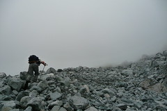
Susan C. on the Chain Lakes Loop near Mt Baker:
“Border traffic at the Sumas crossing was minimal; and once across, it is straightforward driving to the Baker National Park. We couldn’t have chosen a better day to head down to the Mount Baker area. The temperature stayed in the low 20s, so the hike was cool and comfortable and almost totally bug-free. The trail lived up to its name – it really is a “chain” of lakes. We started at the lower end of the loop near Bagley Lake and by the end of the hike had lost count of the number of lakes. Suffice to say, it was well worth the drive down. We caught various aspects of Mount Baker, many of which were positively stunning. By the time, we neared the upper end at Artist Point, the trail was starting to feel like the Grouse Grind. Getting on from the less popular starting point, we had avoided the crowds for most of the way.

At less than 500 m in elevation, the hike was not especially challenging but was perfect for a bunch of keen photographers not too worried about breaking any records. The loop (11 km) plus a 3.5 km descent on the Wild Goose Trail back to the parking lot at Bagley Lake took just over five hours. This distance does not include our detour down to one of the lakes for very pleasant lunch break.

On the way home, we stopped at the Mount Baker Vineyards for a sampling which cost us each US $5. The wines were mediocre but it was, nevertheless, a pleasant little side trip. And you get to keep your sampling glass as a souvenir! After that, back across the border for burgers at the White Spot. Again, border traffic was light at around 6 pm. All in all, a most enjoyable day with great company.”

Hanes Valley 15/08/09

Michelle in Hanes Valley and on Crown Mountain:
“All this one mustered was a three-some, which turned into a two-some. John and I had an extended but very enjoyable day completing the full circuit of essentially Lynn Headwaters to Norvan Falls, Hanes Valley, Crown, back to Grouse via Little Goat Pass and Goat Mtn trail. From the PACKED Grind parking lot (packed BEFORE 8am!?) we shuttled to Lynn Headwaters, entering a cloud of fog that we hiked through Hanes. Good thing this quiet valley is truly well marked- little decorated cairns wrapped in glowing florescent orange flagging guided us as we hiked literally from marker to marker in pure faith through the mist in the boulder field (though the GPS agreed). Perhaps not being able to see where we were going or back behind us helped our mental disposition as the elevation gain was seemingly painless. Crown was a little more challenging – especially when you do a bunch of extra wet scrambling/searching at the base when you don’t have to (if everything is mist- follow the orange flagging and red/white bulls-eye paint markers CLOSELY by the beginning of the rock base/forest edge, skirting AROUND on a sideways approach for some time. The final scramble up the summit is minimal. But save some gusto for the stiff climb back out of Crown Pass to Little Goat Pass. I wouldn’t want to do any part of this circuit any wetter than we did on account of what nasty business it would be (too slippery!). Uncrowded valley, “mist”-ical pictures, lovely views atop, tram down, ahhhhh.”

08/15/09 :: Hanes Valley/Crown Mtn

Black Tusk 15/08/09

Pablo at Black Tusk:
“Four of us headed to Garibaldi Provincial Park to hike Black Tusk. We had a very good pace. According to BC parks it takes 8.5 hrs one way to the viewpoint. It took us 8 hours round trip to the chimney including breaks and going back trough Garibaldi Lake. The trail is snow free. The sky was cloudy so some times the visibility was reduced. It was a little bit cold at the top. No mosquitoes at all.”

Macdonald Peak 02/08/09

Peter on Macdonald Peak:
“Irina, Evgeny, Henry, Laura, Jen, Nikita, Carolyne, Neil, Ben, Behrouz, Dan and I braved the heat, sun, bugs, stinging nettles, dead fall on the trail and various other challenges to accomplish a variety of personal goals. The removal of a bridge across the Chilliwack River at the original Radium Lake trailhead means we had to start 2 km upstream in the Chilliwack Lake Provincial Park, and back track along the Centennial Trail to the junction with the trail. We set out at 10:20am, and set a good pace, climbing steadily to Radium Lake. After a feed and watering, we headed up the classic-looking col between Macdonald Peak and Mt. Webb. The trail from the parking lot to the col is well-marked, but because of recent dead fall in a lot of the upper sections, a little tricky to find and slow-going in some areas. There is a suspension bridge across Radium Creek for the first crossing: it needs repair so caution is in order. Close to the lake there is a beautiful undulating Hemlock forest to enjoy, and two patches of stinging nettles and bugs to hate. The last push up the col is steep with almost no shade: hot and brutal. From the col, most of us summited Macdonald Peak (Nikita and Jen fit in Mt. Webb as well!). The route to the Peak is sufficiently marked with cairns and tape. Scrambling is moderate, with some fun big boulders at the end. Huge granite slabs and excellent views on top. Fires on the forested mountain one valley over meant we had helicopters scooping up water from Radium Lake, landing at the col, and giving us a celebratory fly over when we were on the Peak. After a long and tiring descent, the main group got back to the parking lot at 9:30pm. Plan on 5-6 hours to the summit, and 4-5 hours down. Bring headlamps. A challenging and rewarding hike. Terrific group!”

Lake Ann 31/07/09

Pablo at Lake Ann:
“When I posted the call-out, I received a couple of messages that the road was blocked and the trails were covered with snow. We decided to go to Mount Baker anyway and we asked the park ranger station about the conditions. We decided to go for the Lake Ann Trail. The road was opened last Friday and we only found a couple of small snow patches. The trail starts at 1500m elevation so it was not too hot. We found lots of bugs including black flies.”

Mt Macfarlane 26/07/09

Peter on Mt Macfarlane:
“Lucy, Kevin, Luke, Pavel, Sebastian, Irina, Nikita, Katherine, Hurrian, Jeff and I had an outstanding trip summiting Mount Macfarlane on July 28. The morning drive to Chilliwack was not promising, as we went through fog and cloud. However, 5 km past Chilliwack, we emerged into sunny, clear skies that stayed with us the whole day. We set out on the trail shortly after 10am, and set a fast pace as we climbed steadily to Pierce Lake. The trail is well-marked, filled with switch backs, a boulder field, creek crossings and undulating forest. We emerged onto a steep clearing (created by avalanches), thick with bushes and wildflowers. 20 meters below was the large and enticing Pierce Lake, and cool views of the surrounding mountains and Mt Macfarlane. We pushed onwards, navigating some muddy sections through Pierce Meadows, and soon saw the spectacular falls running down the 100m headwall that creates the upper lake. The trail approaches the headwall by running up a cleft in a set of forested cliffs. Well-placed, sturdy ropes and strong roots help the hiker scale this section. We emerged from this cleft and faced a steep gully of loose small-medium sized boulders. Stay to the right of the boulder field and hike along the forested border. Flagging tape can be found intermittently on low-lying bushes. Near the top of the field, avoid the flagged trail that branches left and crosses the boulders (to Mount Pierce?). Stay on the flagged trail that veers right and climbs over a steep shoulder of the forest. We popped out onto a beautiful, slightly-inclined, heather-filled plateau just below the waterfall. The trail stays left of the waterfall, mounts the headwall and greets you with a beautiful alpine lake sitting high in the mountain cirque. The water is cobalt blue, aquamarine and crystal clear: like a tropical paradise. A few perfect camping spots to be had. After a short break, we pushed on up the well-marked, steep trail that follows a ridge to the top of Mt. Macfarlane (minimal exposure, but more difficult if conditions are wet). We reached the summit in 4.5 hours! Spectacular weather and views, and hard to leave. Retracing our steps, we spent more time at the upper lake, carefully descended the steep boulder field, and had an amazing swim in Pierce Lake led by Kevin and Lucy. The day was capped off with a celebratory ‘feeding and watering’ at a local pub. Fantastic hike and fantastic people!”

Dennett Lake 25/07/09

Stacey at Dennett Lake
“Brian, Erin, Justin, Maya, Michal, and Stacey hiked up to Dennett Lake on Saturday. The trail head starts about 5 minutes up an old logging road. The trail climbs fairly steadily upwards until Munro Lake, and was mostly under tree cover which provided protection from the hot sun. We got a bit confused in our directions once at Munro Lake – 103 Hikes shows the trail heading around the west side of the first lake – we took a wrong turn and started following an old creek bed that may have been part of the Village-Lake Trail, then after back tracking, we took what we thought was the correct trail around the lake but the markers were sparse, we had to do some bushwacking and the ground was quite wet. After persevering and following the lake around, we did eventually find a sign for Dennett Lake. There’s actually a junction a few minutes before this sign that takes you on a path between the first and second lakes, I recommend taking this as it was super fast, easy and dry and meets up with the spot where the trail initially comes out at the lake. The hike up to Dennett from here took about an hour and was muddy and wet in sections (no snow though) and a few of us got mud soaked up to our ankles. There’s a great viewpoint near Dennett Lake looking back down towards Munro Lake. Dennett Lake was AMAZING and GREAT for swimming in! Not too cold and very refreshing. We hung out there for almost an hour, and on the way down got caught in the huge thunder, lightning, and rain storm! Cool! Overall great hike, we were all smiles. Oh, and apparently there was a black bear on the trail according to another hiker we talked to at the end, but we didn’t come across it.”

Cheam Peak 25/07/09

Su-Laine on Cheam Peak:
“With alpine flowers in full bloom and a winding trail through the meadows that gives ever-changing views of nearby mountains and valleys, Cheam was one of the most rewarding day hikes I’ve done yet.

The consensus was that it wasn’t all without adversity though: the infamous 4×4 road access, swarms of flies of various shapes and sizes that morphed into citronella-immune mosquitoes at higher elevations, and an approaching thunderstorm all made the day more exciting.

For Cheam, people don’t ask about trail conditions as much as road conditions. We were in an SUV and had no particular difficulty, but it was a challenging drive with some ‘don’t look down’ sections, and the last 11 km of logging road took us nearly an hour each way. Total driving time from Brentwood Mall in Burnaby was 3 hours each way. The parking lot was full of SUVs and 4×4 trucks; we’d heard that it’s possible to drive up in a 2WD car if you’re willing to wreck it, and to our amazement we did see one midsized car there. I still can’t understand how it got up there. The Chilliwack forecast was for a possible thundershower in the late afternoon, but we started to hear thunder at around 1:30 pm and the electricity in the air was making people’s hair stand up. I literally ran the last few minutes to the summit, snapped a few pictures, and got off it as quickly as possible. The descent was very pleasant though, with alternating sunshine and cooling clouds and drizzle. We were happy to be on Highway 1 on the way home when the full storm hit.”

Crown Mountain 25/07/09

Peter on Crown Mountain:
“Seven hikers made their way through Lynn Headwaters and Hanes Valley up to Crown Mountain and then to the Grouse Chalet. Very diverse terrain: forest trails, a creek crossing, boulder fields, steep to very steep parts and a bit of scrambling. High temperatures and humidity made us sweat and many flies and mosquitos kept us from stopping for too long. Great views from the top, no snow, and a bear with a cub from a safe distance. Ten hours of hiking and the rain started only after we arrived at the Chalet.”

Galiano Island cycling 24/07/09

Dana on Galiano Island:
“Five of us caught the morning ferry on a Friday to Galiano. The weather was overcast but the sun came out once we arrived and it quickly became very warm. Though the ride to the campground is only 10 km, the roads are windy and hilly, and with weighed-down bikes and the hot sun it felt much longer. On Saturday, two of us rented kayaks and explored Montague Harbour and the other three biked about 10 km up-island to hike Bodega Ridge. Highlights of this easy hike with desert-like terrain were watching eagles soar beneath (and above) us, and the views of Salt Spring Island and beyond. We also enjoyed the thunder and lightning storm that night (after a quick swim), though instead of huddling in tents we took advantage of the free Hummingbird Pub shuttle bus to indulge in drinks and some incredible pie. Sunday’s ride back to the ferry took in a different route, encompassing the cemetary (which has a nice view of Active Pass and sunning sea lions). To sum: Biking Galiano is not for the faint of heart. There are many hills (both short and steep and long and gradual) and the pavement is cracked and broken in many spots. Still, it is rewarding and a beautiful place to explore over a weekend.”