Yearly Archives: 2016

Mt Harvey, 23 Jul 2016

Erin P. on Mt Harvey:
“Three of us tackled Mt. Harvey on Saturday. We arrived in Lions Bay to find the meagre 5 or 6 parking spots at the trailhead already taken. However, I was pleasantly surprised to find there are actually quite a few parking spots around the village without the dreaded tow-away signs. Do be careful not to block driveways, etc.

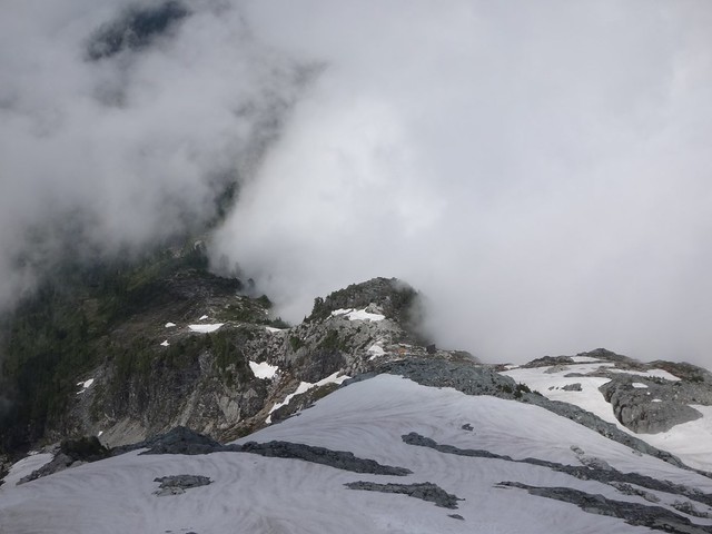
This trail has a well-deserved reputation for being relentlessly steep. We powered up at a good pace, grateful for the cooler weather. Near the top, the bugs were out in full force, and we wondered – what can they possibly eat when there are no hikers? I would bring bug spray if doing any of the Lions Bay hikes in the near future.

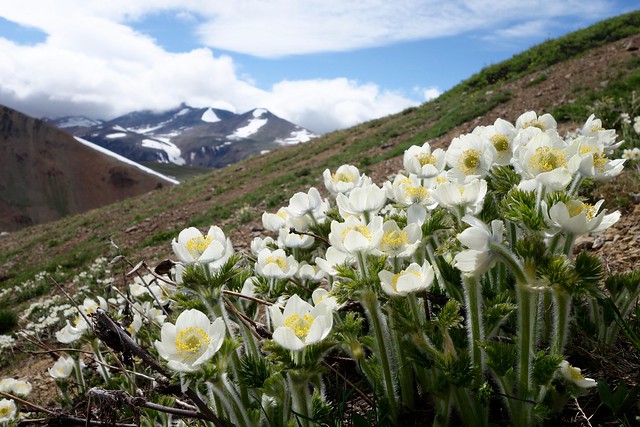
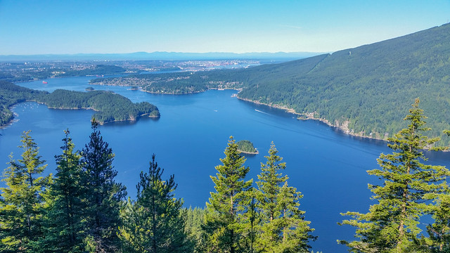
After lunch near the summit we headed down, enjoying the views of Howe Sound on the way. Despite the many cars in the village, we only met 3 other parties on the trail. Our total time was about 6.5 hours. Thank you Eugene and Laurel for joining me on my first callout!”

Golden Ears, 16 Jul 2016

Eugene Y. on Golden Ears:
“This route has a well-deserved reputation of a most challenging trail in the Lower Mainland. The trip felt much longer than 24 km, as it also involved almost 2 km of cumulative elevation gain (according to our GPS). Traveling at a brisk pace, we made it to the peak in 5.5 hours, however, the return trip took us well over 6 hours, as some parts of the trail were quite slippery. The steep middle portion of the trail was particularly sketchy on the descent; it would definitely benefit from some additional foot steps and permanent chains or ropes.

Panorama Ridge below the shelter was mostly snow-free, however we had to cross a large snow field on the way to the peak. The condition of the snow varied. An overnight hiker told us that it was somewhat icy in the morning hours. However, the snow got softer by midday, even though it would still require some efforts to make foot steps. We had to carefully navigate the snow field in order to avoid the steeper portions. Even though we’ve seen a few groups having made it to the top without crampons, many of us were really happy to wear microspikes.

Trekking poles (or even an ice axe) are really needed on this snow field. In fact, even with snow poles, some of us found it difficult to perform a controlled descent. Using poles for stopping yourself while sliding definitely requires some practice; moreover, poles can easily bend or even break if not held properly, as some of us discovered.

The final scramble to the top was, perhaps, the most enjoyable part of the route. We were lucky to get some really dramatic views through the fog.

Overall, this was quite an epic trip with a wonderful group of people.”

View from Golden Ears peak

Southern Chilcotins, 30 Jun 2016

Chris N. in the Southern Chilcotins:
“Matt, Doug and I spent 4 days camped in Graveyard Valley in the Southern Chilcotins and exploring the surrounding ridges. Access was via the Hurley (thoroughly unpleasant but 2wd-able), the Tyaughton Lake road (washboard-y corners but 2wd), Taylor-Mud Connector (slick when wet descending to the Tyaughton Creek crossing but 2wd otherwise), Mud Creek FSR (excellent; very 2wd), Mud-Paradise FSR (one berm 2/3 of the way down the hill to Tyaughton Creek might be 2wd; pothole-y after hill but reportable 2wd beyond the Tyaughton Creek trailheads) and the Relay Creek FSR (totally not 2wd right from the start). The last road requires high clearance 4wd and lots of nerves. There’s channeling, creek crossings, deep rutting, mudpits, off-camber sections with exposure and one steep off-camber hill with bad traction. We spent 1/2 hour doing some road work (bring shovels!) and made it to the road end. But this road isn’t going to last many more years. Once on the trail, they are generally easy to follow but wet at this time of year. We spent most of our time off-trail up in the alpine though and encountered very little snow – even above 2500 m. Deer, wolf, bear and moose tracks abound. Saw a sow grizzly with 3 yearly cubs and a wolf. And met no-one else. An excellent trip to my favourite part of the province.”

Flower Forest

Skyline Divide, 26 Jun 2016

Phil A. on Skyline Divide:
“Mount Baker beckoned, and four Wanderungers answered the call with a perfect day hike along the Skyline Divide. After navigating the pockmarked road (low clearance cars beware), we set out through the woods. 450 m later we popped out into flower-peppered, emerald green, and a snow covered ridge line. From there, it was one spectacular view after the another, and an afternoon of hiking, laughing, and bum sliding. The ridge that runs towards Mount Baker seemed to go on forever, and a wise Wanderunger would do well to bring a tent to spend at least one night atop one of its numerous knolls. Sad that we couldn’t overnight, we turned back and headed to Sumas for some Mexican food.

Elevation Gain/Loss: 1200 m/-1200 m
Distance: 13.5 km (most of the trail is easy to follow, but some parts are still snow-covered).
Time: At a slow/moderate pace you can reach the ridge line in 1.5 hours. After that, you can go as far as you want. We went as far as N48° 50.527′ W121° 51.464′ before turning around.”

https://www.instagram.com/p/BHJjwFrAe3c/

Flora Peak, 25 Jun 2016

Phil A. on Flora Peak:
“Confident that the weather would clear up, your heroes set off to conquer Flora Peak in Chilliwack Lake Provincial Park. The hike was a good mix of mossy second-growth forest, alpine meadows, talus slope-scrambling, and ridge exploring. We also timed it perfectly, and the clouds parted as we reached to summit. No real snow except for a few north-facing patches. Rather than take the trail down, we ‘shwacked through the flower fields and got a fantastic view of Chilliwack Lake.

Elevation Gain/Loss: 1520 m/-1520 m
Distance: 12.7 km”

https://www.instagram.com/p/BHGrxn5A1Ki/

Slollicum Peak, 4 Jun 2016

Phil on Slollicum Peak:

“In search of a snowy summit on a scorching day, four intrepid Wanderung-ers headed to Slollicum Peak. After muscling our 4×4 up to the trailhead, it was a 4-hour hike on a moderately well marked trail. We were greeted with blooming flowers, the odd stinging nettle, and babbling brooks. The summit was snow covered, and offered a great 360 degree view of the hanging Slollicum Lake, Mt Baker, Harrison Lake, and the countless surrounding peaks.

Distance: 13 km
Elevation Gain: 1440 m
More hike information on Club Tread

https://www.instagram.com/p/BGSCveWtuJE/

Diez Vistas, 4 Jun 2016

Bob H. on Diez Vistas:
“Three of us went for a moderate to fast-paced hike to one of the most popular hiking trails in the Lower Mainland.

The weather was warm, but it was nice and cool under the forest canopy. Diez Vistas is Spanish for ten views.

Most people doing this trail complain that there are only 3 or 4 views (how sad, right?!). Anyways, I promised my fellow hikers 10 views and I actually gave them 11.

Five of the original views are obstructed by trees now, but there are 5 more views that were never ‘official’ vistas, including 3 on the east loop, which most people don’t know about. The 11th vista is actually on the Lakeview Trail, which we took a shortcut to. We finished the hike in 4 hours.

For more info on this hike, check out this blog: http://www.buntzenlake.ca/diez-vistas/

Original Vista No. 1 view

Elk-Thurston, 31 May 2016

Andy G. on Elk Mountain:
“Talk about a great day out – the views were expansive, the flower display was amazing (over 40 types of flower identified!), and the pie at Chilliwack airport a very welcome treat. Estafan, Julianna, and Michelle joined me (and we later bumped into Shawn near the first viewpoint) for a spectacular day of hiking on Elk. We even made it up to the viewless peak of Thurston, whose only saving grace was a patch of tiny glacier lilies!

A little bit of mud (no doubt from last Saturday’s rain), but the trail is otherwise in good condition and as steep as ever. No snow before the cairn on Elk, and only a couple of patches on the way to Thurston. There’s a new (to me) outhouse about 50 m up the trail. Best of all, I think the flower show will only get better over the next few weeks.”

Sumas Mountain, 23 May 2016

Andy H. on Sumas Mountain:
“Sarah, Anya, Adam & Sebastian joined me for a nice hike up Sumas Mountain on Victoria Day. Trail was in good condition with a number of muddy patches. Walked through the forest in and out of patches of fog until reaching Chadsey Lake, where light rain greeted us. A group or two of hikers by the lake and two fisherman – with no catch so far that day. We climbed up to the summit, having lunch at the eastern lookout – looking out on… mist! The clouds weren’t going anywhere so we headed back down to the car and on to the pub in Abbotsford for a celebratory drink before heading home. Great day out only an hour from Vancouver!”

Garibaldi Lake, 8 May 2016

Chris N. at Garibaldi Lake:
“Unlike the Cheakamus Lake trail, there were no blowdowns on the Garibaldi Lake trail at all! Snow patches started around 4.5 km and was largely continuous beyond the 6 km mark. It doesn’t look like many people had headed up to Taylor Meadows – hardly any tracks in that direction. Snow looked to be about 1-1.5 m deep at the lake. It was largely consolidated so snowshoes weren’t needed (and would have been a hazard in the narrower bits coming around the upper barrier lake). Microspikes will help but aren’t really necessary either. The snow gets a bit sloppy in the last 100m before the lake and around the lake edge. There are small pools of water around the lake edge and we ran into a few skiers coming off the Garibaldi traverse so I guess the lake is still crossable (though I wouldn’t risk it).”