Tag Archives: Whistler

Brandywine Mtn 06/06/09

Chris M. on Brandywine Mountain:
“The 4×4 access road was snow free, unlike the top part of the trail. Glad to have bypassed it. We followed the last branch and quickly entered the meadows. Except for the creek, it is still covered in snow. A collaborative effort in route-finding got us up to the ridge where we set up camp. A site meant for the gods – the views in all directions were fantastic, especially since we seemed to be in a pocket of blue sky. We camped on snow, but rock outcroppings provided a nice place to relax and eat. We went for the peak in the morning with 3 of us reaching the 2213-m summit. Fairly easy scrambling involved. Easy descent and nice drive back to Vancouver by 3 pm. Thanks to Erin, Dorothy and Stacey for making this an excellent experience.”
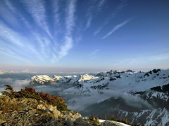
The View

Mt Sproatt 16/05/09

Ahmad on Mt Sproatt:
“We were lucky in many ways of how our hike turned out. We headed first to Whistler Olympic Park. I was surprised by how little snow existed there at altitude 850 m. The forest looked too thick to be bushwhacked and the snow conditions looked bleak. We headed then to an abandoned gold mine which I thought would be better approach as it was located at 1000 m and it was on a more direct route. We parked at about 960 m where the snow line started. We were then pleasantly surprised to find a road that took us all the way up to the ridge (it is possible that this is drivable to about altitude 1250 m in summer. I also think that this road is used by snowmobiles in winter). Soft and slushy snow on the ridge took a big toll of energy from us. It was not sunny but it was definitely a hot day. We got to 1 km away from the peak at altitude 1720 m but we then decided that it was not really worth it to complete the hike. Instead we headed to a false summit at 1750 m and we called it a day. I am very sure that we could have made it.”

Cougar Mountain 07/12/08

Chris on Cougar Mountain:
“Albert, Alex, Cara, Jamie, Nancy, Ribeka, and Tessa joined me in a snowy exploration of the western flank of Cougar Mountain. The road to Cougar Mountain (16 mile creek road) leaves Hwy 99 just after Green Lake. We encountered snow fairly early and the potholes had turned into slushy ponds (doesn’t look like this road is plowed but sledders probably use it later in the year). The hill after the bridge took some effort to drive up and we slipped and slid up to the stables to park. To get to the cedars from there, follow the road up taking a right at an obvious fork and sticking to the main road until you start to encounter faded signs and follow those. The road turns into a gentle trail and we found ourselves in the cedar grove about an hour after leaving the cars. We then headed off-trail following the creek uphill. We topped out at 1200 m overlooking a small pond and temperatures stayed above freezing for the whole route.”

Cougar Mountain - December 7, 2008