
Alice on Coliseum Mountain:
“We changed to go on Sunday instead because of the weather. Thank God for the perfect weather, clear gorgeous view surround and most of all, no injuries and we’re all safely back although some of us arrived very late. The trail is clear for the most part, only patches of snow still towards the top but not dangerous at all. Roots are slippery as it soaked in the snow for so long, I doubt if they’d ever dry under the forest but it’s manageable. A little bit a scrambling but not much and not hard. Nice to be hiking mostly under the shade and varied different terrain. It’s difficult and strenuous in some parts but it’s not as bad as I heard. But it’s definitely worth to wait for a clear sunny day to go except if you just want a good workout. It’s VERY long, 25 km! It was a great hike, recommended!”
All posts by andy
Eagle Bluffs 03/08/08
Su-Laine on Eagle Bluffs:
“It was a splendid day for this underrated hike. The route is, as others have described, very steep in places and the descent was more strenuous than going up. Wayfinding was straightforward with Paul’s directions and the latest version of the ‘103 Hikes’ book; the 1994 version doesn’t describe the lower part of the trail. The lower trail could be a good low-elevation short hike too, amongst beautiful old trees.”

North Coast Trail 02/08/08
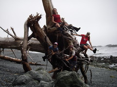
Sandra on the North Coast Trail:
“What an amazing week our group of 11 had on the 1-way 80 km trip through the newly opened North Coast trail and tried-and-true Cape Scott trail. We lucked out with only a few hours of light rain on 1 of our 7 days on the trail (4½ days on the NCT, 2½ days on Cape Scott, 2 travel days). There was lots of wildlife, with everything from bears and gray whales to a couple of porpoises playing around the front of our boat for 10 minutes during the water taxi ride on day 1 (and don’t get me started on the “whale-bear”).
Since we decided to hike the North Coast trail heading west, ending up on the Cape Scott trail, we did a 3 hour car shuffle at the end of day 0 to leave a couple vehicles in the Cape Scott parking lot (our end point). Our first day on the trail started with an hour-long water taxi ride from Port Hardy.
What was in store for us on the North Coast trail was apparent right away – straight off the rocks where the water taxi dropped us off, we had to haul ourselves up a steep embankment into the forest with the help of ropes. And – this was only the “moderate” section! The “very difficult” sections were great… ahh… for team building?!? Lots of muddy bluffs had to be scaled or descended with the use of ropes. The group did a fantastic job of yelling tips at people hanging from ropes on where to put their feet, passing backpacks along when sections were easier done as a pack-free scramble, hand-holding across sketchy sections, and of course taking pictures when people fell off the trail before helping them up (only after checking that it was just pride that was hurt, of course!).
I now have a new appreciation for the fact that a “minimal elevation gain” hike can be harder than summiting a peak! The NCT is a fantastic trail for anyone who wants to experience coastal hiking / loved the West Coast Trail, but wants a bit more challenge and no crowds. Kudos go to the folks that have punched this new trail through!!”
Mt Strachan 02/08/08
Pablo on Mt Strachan:
“Seven of us headed to Mount Strachan on Saturday, the forecast was cloudy with sunny breaks, don’t believe the forecast. We started from the back, there is still snow and were steep and slippery, and it started raining. We made it to the top of the North peak where we got a spectacular 360° view of the cloud. We had the chance to test our equipment and realized that the waterproofness of the allegedly waterproof gear is far from being waterproof, so I’m going back to my $2 plastic cover. When we came back to the city, just 10 km away, we founded lots of people enjoying the sun on the beach.”
Cape Scott 31/07/08
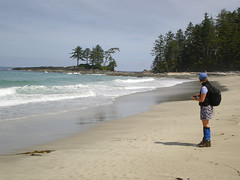
Carollyne at Cape Scott:
“Charlie, Curt, Lucy, Ribeka and I caught the 8:30 am ferry to Nanaimo for a rainy drive and dinner at The Scarlet Ibis in Holberg, before beginning the muddy trek to Eric Lake at 7:30 pm. It was hard to imagine what a `muddy trail’ meant before Cape Scott, but we were all glad we brought gaiters. Fortunately, Thursday night saw the last of the rain. Friday, we hiked out on the waterlogged, but lovely forest trail giant spruce, stunted pines moss, ferns and the largest skunk cabbage I’ve ever seen – over boardwalks, bridges and mud to Nels Bight beach in bright sunshine, quickly throwing off our boots for a run into the ocean. Amy, another Wanderunger and a friend were there to greet us. That evening we sighted 3 grey whales blowing and fluking for several hours before having our first amazing 3-course dinner and sharing Amy’s campfire. We had heavy packs, but great food. Saturday, we day hiked to Experiment Bay, Guise Bay and the lighthouse, enjoying brilliant sunshine, stunning beaches, end of the earth views and interesting chats with the lighthouse keeper before another evening of whale sightings. Sunday, we were relieved to have a somewhat drier trail for the 18 km trek to San Josef Bay. While on the trail, the writer lept over a mudhole a little too recklessly, resulting in a full body and face plant in the mud with Curt at a full run in rescue. Luckily, a good laugh was the only consequence. Monday, some of us enjoyed San Josef Bay’s beaches, sea stacks and heat while others hiked to the cold chill and clouds of Mt. St. Patrick. Another starry sky, a great dinner and campfire filled our last night at Cape Scott. Everyone contributed cheer, great conversation and teamwork to make this a fantastic trip. Curt gets special thanks for helping get our packs on our backs and all the driving too. Sorry that Daniel was held up at work at the last minute so couldn’t make the trip.”
Southern Chilcotins 29/07/08
Chris on Slim/Gun/Taseko in the Southern Chilcotins:
“Dean had to drop out so that left just Cara and I for a week in a quiet corner of the Southern Chilcotins. The Hurley road was in great condition earlier this year but is deteriorating – still drivable at speed but bumpy, pot-holey and washboardy. Slim Creek FSR was great until Jewel Bridge but only OK 2wd after that until the blocked bridge at 28.5km. An hour of walking took us to the end of the road and the start of the very wet trail (no way to keep your feet dry on this one). Soon we left the trail and spent the rest of the trip off-trail wandering the alpine or bushwhacking for days. Despite less-than-stellar weather (rain/hail/snow every alternate day), a scaled-back itinerary (20km of off-trail travel a day is insane) and a tent fly that was a sheet of ice on the last morning, we had an amazing time. No bears or wolves (there were plenty around given the number of prints we found) but we did have close encounters with a bull moose and a porcupine. We found 40 year old mineral claim posts and animal bones, gazed down on massive glaciers, glissaded snow slopes, forded icy streams, strolled meadows that extended forever and saw no-one (except the helicopter pilot who buzzed us one morning). Days of rain followed by a beautiful sunny day resulted in a hatch of mosquitoes of biblical proportions which turned our bushwhack back to the trail on the last day an epic of endurance. It’s a beautiful place and I’m already planning a trip (or 2) back.”
Pender Island 27/07/08
Markus cycling on Pender Island:
“Five of us enjoyed a beautiful sunny day on Pender Island. It was hillier than I remember it and the quaint pub and marina at Poets Cove is now a resort and spa. We still enjoyed a nice patio lunch and then spent some time exploring the island. We ended up taking the evening ferry back and enjoyed a beautiful sunset while on the trip back to Tsawwassen. A good time was had by all.”

Sproatt Mountain 26/07/08
Chris on Sproatt Mountain:
“Adam, Cara, Dean and I spent the weekend avoiding the Pemberton crowds on the edge of Whistler. The Sea-to-Sky was quieter than usual as we headed up and we were the only cars at the Rainbow Lake trailhead. The trail was in pretty good shape to our turnoff just past the Gin and Tonic bridge. A faint trail disappeared after crossing the creek and we made our way through open heather meadows to the larger of the two Gin and Tonic lakes. We continued up past the meadow behind the lakes, climbed to a low point in the ridge crest and found camping spots near a small tarn just outside the watershed. As soon as the tents and tarp were up, the rain showed up. It didn’t last long and left enough time for everyone to explore Mt Sproatt (beautiful pocket meadows), ridges and ponds (chilly swimming given the weather). Next morning, we awoke to rain which let up at about 9 leaving us wrapped in clouds. We packed up in the late morning and headed north up the ridge using map and compass to navigate the lumpy terrain in almost white-out conditions. We came out at the saddle between Hanging and Rainbow lakes and returned to the cars along the Rainbow Lake trail which was very quiet (saw perhaps 7 people in total all weekend). Traffic back to town was, again, amazingly light.”
Mt Cheam 26/07/08
Michelle on Mt Cheam:
“A long road to Cheam, but worth it. The 4×4 road definitely takes some extra time to account for (and good clearance and good tires definitely make it easier). However the views are there even before you start at the trailhead. Something to look at every step of the way. Lush green meadows, fields of flowers, mountain peaks everywhere and an end destination panoramic view to boot. You are truly on top of the world at the precipice of this peak. You are also exposed almost every step of the way – sun protection and hydration are a must. Although sunny and clear, the wind and milder temperature worked in our favour (I wouldn’t want to try this one on a 30-degree day).”
Mt Frosty 26/07/08
Andy G. on Mt Frosty:
“Seven of us car-camped at the Hampton campground on Friday night, setting off for Mt Frosty the next morning from the Beaver Pond trailhead (we parked the other car at Lightning Lake for our return). Note that the old bridge mentioned in Dawn Hanna’s description of the Windy Joe trail is ruined but it was still possible to get across the creek to reach to the bridge over the Similkameen River. Once across the bridge we were on the trail proper and our first destination was the old fire tower atop Windy Joe. After a snack break there we back-tracked downhill a mile or so to join the loop trail to Mt Frosty. This section of trail is a gem: easy on the feet with a gentle gradient. It starts off in open woodland, gradually giving way to spectacular flower meadows and views to the south before finishing off with a series of switchbacks through scree up to the Windy Joe junction. We spent over an hour at the summit of Frosty, admiring the fantastic view and playing hide-and-seek with a pika. Our descent was via Larch Plateau to Lightning Lake for a swim just as the sun dipped below the mountains, followed by dinner and a starlit camp fire. Sunday we were all too tired to do much so we drove up to the start of the Heather Trail and spent a couple of hours taking a bazillion flower photos before heading home. Bugs were plentiful and hungry.
Saturday was a long day – it took us almost 11 hours – but it was worth every minute. Highly recommended for a two car trip.”