
Chris N. in the North Stein Valley:
“Colleen and Cara joined me on a 3-day trip into the Brimful Lake area of the North Stein. We used the Texas Creek Road for access which is in rough 2wd condition in spots though good AT tires would be needed for traction and there is a fair amount of loose rock on the road which may need moving if you have low or average clearance. The waterbars start around km 17 or 18 and there is good parking at a meadow around 19 km (it’s obvious). After this point, the deeper waterbars start in earnest and even in a short wheel-base 4wd the going would be slow and annoying. We walked the rest of the road following some new Road Centerline tapes (indicating plans for new logging) up the western fork to the trail. Don’t follow the tapes into the forest beyond the last landing; the trail starts on the west side of the landing – look for cut logs places to avoid the boggy bits. The trail starts wet but improves to a good footbed and quickly emerges into meadows. At the pass entering the Stein, head south up the ridge to gain about 50 m elevation before the trail turns right again and sidehills, maintaining elevation. There’s plenty of cairns through a rock field and the trail is visible all the way to the lake. It took about 3 lollygagging hours from car to camp. There’s a bear cache and a green throne-style outhouse (open to the elements but with a good view) and plenty of good camping in the massive meadow south of the lake. On our middle day, we headed south and caught an old trail south and east to explore some nice ridges and meadows that bordered Cattle Valley. We attempted a traverse of the mountain to the east of camp but the ridge got pretty nasty. We also did shorter hikes out on the ridge to the south-west of the lake and around the lake to the pass to the north. One of the highlights was spotting a wolf that was hanging out about 500 m south of the lake on the first evening who gave us a thorough barking-at. There were also plenty of marmots and smattering of pika, a couple ptarmigans and assorted other birds.”
Category Archives: Multi-day
Chuckanut cycling, 19-20 May 2013
Keith F. cycling Chuckanut Drive:
It turned out to be a beautiful weekend for a little bike jaunt down to the US and A. After organizing gear and leaving cars at 165th Street and 8th Avenue (good spot) it is a 5 min ride to the border. The plan was to bike from Vancouver but I changed the trip to Sunday-Monday as Saturday was looking really poor weather wise and wanted to get where we were going. When biking past 100s of cars to easily get to the front of the line, it is hard to not feel a little smug. Then again you must be honest with yourself and realize usually you don’t bike across the border and you usually sit with the masses of cars. But today was not one of those days: 5 min border crossings.
Using a map from a local phone book we sufficiently meandered our way around Birch Bay State Park and then around the lovely BP refinery and arrived at Bellingham. The I-5 is not the nicest stretch of road, but all the side roads we took are great. Luckily we were thirsty and hungry after biking down and we happened to land at Elizabeth Station bottle shop and bar. Good sandwiches, beer on tap, and lots of options for taking many many different beers home.
After this it was a quick shot to Fairhaven. It is touristy and nice for sure. We all relaxed on the lawn (greenest lawn in Fairhaven I reckon) in front of the Colophon Café. We then made our way down Chuckanut Drive. The weather was great and Larabee State Park is not that far down the hills. We pulled into one of the walk-in sites and set up camp (no reservation). There are few food options on the scenic drive (and the possibility they might be closed) so after biking for a bit in the night we elected to turn around as the road is tight and windy – not fun in the dark.
We slept well, it is kind of insane to think a train is going to come barreling through your tent in the night, but that’s what it is like when they pass by. We got up and went up the few hills (they are over really quick) and back into Fairhaven for some breakfast. We did a little shopping in Bellingham and meandered our way to the border and back home once again. Fun group, fun trip!
Trip by the Numbers…
- Number on trip: 4 (reduced max from 8, Rebecca, Susanna, Cheryl, Keith)
- Km’s biked: approx 160 km
- Borders crossed: 2 (US and Canada)
- Animals seen: 1 Possum, one toad (both road kill), 59 cows, 14 sheep, 5 dogs
- Animals lives saved: 13 (helped 2 adult mallards, and 5 ducklings safely cross a road North of Bellingham; slowed down on 99 and put 4 way flashers on for 6 more to way to meeting the group) I wouldn’t say I’m a Super Hero, but others might 🙂
- Fear a train might come directly into the campground in night: 4
- Insane irate driver who disliked cyclists: 1
- Insane irate driver who avoided a heart attack after he relaxed and drove away: 1
- Oysters shucked: 0 (they closed before we got there)
- Options for more trips in Whatcom County: many
Columbia River Gorge, 18 May 2013
Chris M. in the Columbia River Gorge:
“One late cancellation and one no-passport problem left us with only 3 people in the car. Which made relaxing in the back seat a prized position! It took Anna, Tu Loan and myself about 7 hours to get down there.
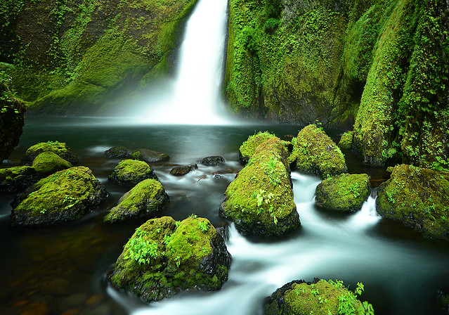
Saturday afternoon we did a 5 mile (8 km) hike that took us past 5 good waterfalls – Wahkeena, Fairy, Ecola, Wiesendanger & Multnomah. The weather was overcast with a little rain – perfect lighting for waterfall photography. We stayed both nights in a reasonable motel at Cascade Locks.
Sunday weather was brighter. So it was a sight-seeing day. We started off trying to walk through Oneonta Gorge but were stymied by one deeper pool just before the waterfall. Six miles of hiking (9.6 km) took us past Horsetail, Ponytail, Middle Oneonta, Elowah & Wahclella Falls. We enjoyed the latter two the most. We had enough time for a visit to Carson, where we had a very relaxing hot springs mineral bath and wrap. Followed by a nice Mexican dinner.
Early Monday morning we hiked 4 miles up Eagle Creek to Punch Bowl & Lower Bunch Bowl Falls. Then we crossed the unimpressive ‘Bridge of the Gods’ over to Washington so we could check out Panther Creek Falls. They were my favourite of my trip. Then it was back on the road and home to Vancouver. We all took turns driving. The conversation and good times never stopped. Border lineups were poor but it does pay to use the Duty Free option.”
Saturna Island 13/07/12
Markus on Saturna Island:
“Thunder and lightning greeted us as we reached Saturna Island giving Brenda, Susanne and I a dramatic start to our trip. Fortunately, there was no rain at our campsite at Narvaez Bay as we settled in. Warm sun greeted us the next day as we made our way to East Point Park. On our way we saw plenty of deer, otters, seals, eagles and a pod of killer whales. In the evening we enjoyed a beautiful sunset after dinner and had an early night. The morning was spent relaxing in our tents as we waited out a drizzle and then made our way back to the ferry terminal for lunch at the local pub (note: they have good gluten free burgers). The ferry arrived, bringing with it the sun, and we saw yet another pod of killer whales on the way back.”
Salal Creek 27/08/11
Cara at Salal Creek and Athelney Pass:
“One adventerous hiker joined me in exploring this rugged and remote valley. The trailhead is accessed via the Upper Lillooet FSR which is currently active. There is a pumice mine at 48 km and active logging off a spur at 38 km. Take the right fork of the Lillooet FSR at 45.5 km, signed for Garibaldi Pumice Ltd. Before you reach the gate to the pumice mine, take the rather overgrown and nastily waterbarred road on the left. The road is very rough in places and requires high clearance or incredible nerves and driving skills. The trail to the creek is well marked though the entrance/exit is not from the creek side. Now the rock hopping starts. Near west Salal an alternate route through the trees is marked (again hard to see). Another minor detour through the trees exists and is quite steep. The entrance to this was not marked so we sailed past. Yet more rocks brings you to a well marked entrance to the forest section along the east fork of salal. The avalanche chutes saw plenty of action this past winter so the alder has been flattened and quite a few trees downed roots and all. Once out of the trees 5 km remains to the pass. The company currently holding the mining exploration rights to the area have made quite a mess just past the most recent landslide. This area saw a lot of snow over the winter, some of which still covers over the creek past the slide. We walked on the snow and were able to avoid the creek crossings below the glaciers. Once in the pass, another snow accumulation permits crossing to the west side of the creek. The mining company, with the help of the BC govt has removed the oil barrels on the bench to the west of the pass. Not sure about the lone barrel further to the south. This weekend the weather was perfect, the flowers were amazing, and the views were stunning. Ian and I spent the middle day exploring the bench to the west, then packed part way out. The third day we compleated the trek and finished up with a well deserved dinner in Squamish.”
Bowron Lakes 23/07/11
John K. paddling the Bowron Lakes:
“July 23 to 29 a group of 6 canoeists completed the Bowron Lakes. Moose and mosquitos were the main wildlife. Though there were stories of many Germans on the circuit, these were unfounded. Three fishing rods and 100 hours of fishing produced a 1-pound trout. We almost caught two very large fish (they were this big…) but they both got away. We met a pair of Americans that had pictures of 60-cm trout. The trip was very quiet and we only encountered a handful of other canoes. Two nights we shared a site with another couple otherwise we were alone the entire time. The weather was weird and changed every 10 minutes. Only once was there a real rain storm (and it was nasty – complete with hail) but we were lucky enough to have checked into a cabin an hour before the storm. To watch a storm roll in through the mountains was one of the many highlights of the trip. Average day was leaving camp around 9:00 am and checking into our nightly tent pad at around 5 pm. Fun ensued nightly.”
Juan de Fuca Trail 29/06/11
Steve C. on the Juan de Fuca trail:
“The Juan de Fuca trail stretches 47 km from Jordan River to Port Renfrew on the rugged west coast of Vancouver Island. Shorter and easier than the famous West Coast Trail which neighbours to the northwest, the Juan de Fuca trail still provides a challenging backpacking route, and is a great introduction to the rigors of coastal hiking.
Our JDF team of semi tent-less strangers (four with tents and two with a “tarp”) (Bala, Susanne, Sherron, Pieter, Angela and Steve) assembled at the China Beach campground on Wednesday evening, after a semi-frantic dash to catch the 7 pm ferry and a precarious convoy across Greater Victoria to the campground. That evening had us all falling asleep to the gentle sound of rain and much “tarp talk” emanating from the two brave tarpers. We all learned of the origins of tarp camping and how it was invented by a rocket scientist who no longer wanted to be a rocket scientist but took on a new passion for the outdoors. Out of this was invented the tarp as a way to minimise weight. Rain that night seemed to confirm the discouraging weather forecast, but after it cleared the next morning we wouldn’t see the wet stuff again until our last night of camping. Before we could start the trail we needed to place our two vehicles at either end of the trail. Two hours of car faffing later, our international team (Canadian, Swiss, German, Indian, Dutch and English) was ready to hit the trail.
The first day’s hike to Bear Beach is rated as “Moderate”, and this turned out to be a fair description, with easy terrain but quite a few ups and downs. Much of the trail was in the forest with the exception of a short section around Mystic Beach. The campsite at Bear Beach was quite busy, but we were able to find a quiet spot to ourselves at the far western end of the beach near to the picturesque “Mushroom Rock”. After supper we were all treated to an “Indian style” campfire, differentiated from its Canadian counterpart by the use of accelerant, an interesting grid structure and a higher success rate. The “Canadian fire” the following night (courtesy of Sherron) was however more aesthetically pleasing, hotter and much cosier.
We were all nice and stiff for the next day’s hike to Chin Beach… rather unfortunate as this was the hardest section of the trail. The trail progressed up and over a series of hills and deep ravines for over 10 km, and had a quite a few sections of slippery and steep terrain with plenty of mud. Physical effort was rewarded with a variety of spectacular viewpoints over the coastline, with plenty of photo opportunities. One of these photo ops provided us with the most dramatic moment of the trip. A branch overhanging the cliff edge proved to be an irresistible lure for most members of the team, including Sherron. Sherron’s tree climbing efforts were cut short by an ill-timed loss of footing, and she plummeted like a tranquilized bear down and out of sight over the cliff edge. Thoughts of splattered bodies at the bottom of the cliffs were however soon dispelled as Sherron’s bruised and scraped form emerged from the bushes that line the precipice. The only complaint was from the photographer of the group, Susanne, who said that while she was waiting to take the picture of Sherron, Sherron disappeared!
Chin Beach was busy, more like a refugee camp than a wilderness campsite. Our “go west” mentality was however rewarded with a quieter spot, separated from the main beach by a small headland. Making our food reserves out of reach of the bears provided much evening entertainment. The first food hanging spot was deemed too close to the tents, which was probably a good call as the bags would have been hanging between two tents. The second option (the metal food cache) was no better as it was completely crammed. The third option involved climbing the rocks of the headland in the dark and some nocturnal rope-work. That worked well and both ourselves and the food were still intact come the morning. The night was noisy with a lot of breaking wave action, and it wasn’t until the morning that we realised the water had come up to within a few feet of the tents. Other campers on the main area had to move in the middle of the night to avoid being swamped… and that would have been our fate if we hadn’t of gone west.
Day 3 was meant to be an easier day, but longer in length than the previous two days. The first couple of kilometres proved to be the trickiest of the whole trip, but soon an interlude of easier terrain presented the first opportunity to partake in one of Bala’s famous “side trips”, down to some spectacular Sea Lion caves. There were three takers and three passers. We’re not really sure what happened on that “side trip” but when we rendezvoused again at Sombrio Beach the three side trippers looked well knackered! The section of trail leading up to Sombrio beach was probably the most spectacular of the whole route. The beach itself was however crammed with the leftovers of the Canada Day festivities the night before… making Chin Beach seem comparatively quiet. Leaving Sombrio Beach behind, we headed up into the gloomy forest for an evening walk to the last of our campsites at Little Kuitsche Creek. Along the way, to our great surprise, it was discovered that Steve had remaining six bars of chocolate. As this was the second last day of the trip, speculation was made as to what these bars of chocolate were saved for – perhaps the bears? We were told that a bear had been seen that morning at the Little Kuitsche Campsite. The campsite was in the forest, gloomy and almost entirely full. In the one spot we found we cooked first before putting up the tents, as room did not allow the tents to be put up first. Evening entertainment took the form of force feeding one another leftover food slop, and binging on uneaten chocolate reserves. The tents were up just in time for the overnight deluge of rain.
The next morning brought the end of the rain and a return to the bright sunny weather we had become accustomed to. The last day’s hike to the trailhead at Botanical Beach was a 14-km yomp over mostly easier terrain. There was one more of Bala’s famous side trips along the way, this time to another dubious Sea Lion Cave, through the back garden of the local “problem bear”. This time there were four takers, with the other two opting for the alternative chocolate and nut binge in the sun. We arrived at the trailhead in good time, and after a bit of creative car packing were able to get us all back to the first car in one trip. We were pleased to get onto an earlier ferry than planned, and were treated on the way back to a magnificent sunset and the sight of orcas in the water…. a fine end to a fine trip… A great trail, great weather and (most importantly) great company. Thanks to Bala for organizing this!”
Broken Group Islands 28/05/11
Sandra kayaking the Broken Group islands:
“Am I really going to do an 8 day kayaking trip with total strangers?” The cursor hovered hesitantly on the ‘send’ button on the Wanderung callout email I had just written. “What’s the worst that can happen?” I thought, and with one click of a finger I eradicated my indecision and sent it hurtling out into cyberspace.
Day 1: Captain’s Log Star Date: May 28. Travel from Toquart Bay to Hand Island. We are standing at the launch site in Toquart Bay. John is determined to pack what seemed like half a grocery store into his kayak and is using his entire body weight to get his rear hatch cover to close over his frying pan. Dennis, the other paddling partner is compact and has extra space which John happily fills.
Confident that we won’t starve, we launch on a bluebird day and head for Hand Island not more than a few hours away. We land on a sandy west-facing beach and bask in the evening sun. There are purple flowers that line the entire pathway to the solar composting toilet, and if you keep going the path takes you to another secret beach on the other side. Dennis catches a rock crab and John cooks it over a fire while we marvel at being able to see the stars. We fall asleep to the sound of the tide creeping closer and the magic of these islands begins to permeate into a place in ourselves that we hadn’t accessed in a long time.
Day 2: Hand Island to Turret Island (stop to see giant tree) then paddle to Clarke Island. As he approaches shore on Clarke Island, John vaults his paddle like a javelin onto the sand and jumps out of his kayak like the snake in a can of nuts that has just been opened. I sigh and stare at my $400 Werner paddle and vow never to let John touch it. Before his boat is even pulled up and life jacket is off, John is fiddling with the bungees on his boat to free his fishing gear.
“Let’s get these crab traps out!” he yells excitedly as his paddle begins to float away with the tide.
“What have I gotten myself into?” is a thought that would linger in my mind for the better part of the afternoon and evening until I was sitting down with my first ever fresh crab presented on a plate in front of me. “Now tell us what you think of your providers now? Did the men do good or what?”
I think about this between mouthfuls of fresh crab. Even if I was barefoot and pregnant in a time when the First Nations roamed this island, I had to admit I would have still been impressed with their manly abilities to harvest what the ocean had to provide.
Day 3: Paddle around and hiking on Benson Island. I have ambitious plans of a long day of paddling around the exposed outer islands. When I tell this to the boys they stare at me with the eyes that a six year old would give you if you had just asked him to turn the Saturday morning cartoons off to go outside and play.
“But we’re tired and we want to go fishing”. We strike a compromise. Benson Island was close by, we could paddle around it and then land and do a hike to the ‘blowhole’ which was a hole in the rocks that sprayed water up like a fountain when the waves crashed into it.
This pleases them and John plops his fishing hook in the water to troll for salmon on the way over. Benson Island was originally open to camping in, but has been recently restricted to day visits only due to archeological surveying that is currently taking place. The Tseshaht First Nations in the area believe that Benson was the place where their version of the Adam and Eve story took place for their people. Anyone landing on Benson can see why. With rugged shorelines, beautiful sandy beaches and lush old growth rain forest, if life was going to start anywhere, it would make sense that it would be on this paradise island.
Did you catch anything? “No,” says John dejectedly before pulling up his line with some difficulty before realizing that he had caught a fish and just had been unwittingly dragging it around the entire paddle. His eyes light up like Christmas, “A fish! I caught a fish!” We take it to shore and John pummels it with a frying pan, a most fitting object of death for a tasty fish.
Just before we land back on Clarke we notice blows from a whale. We watch mesmerized by this underwater leviathan gently rolling to the surface to breath. Scanning the surface for krill with it’s impressive baleen, it swims further away until its blows disappear into the setting sun.
Day 4: Paddle around Wower Island to Dicebox Island around the backside of Effingham, round Gilbert and back to Clarke. Clarke Island, we were told by the fee collectors, is the best campsite in the Broken Group. We believe them immediately. There was a large sandy beach, the kind your feet loved sinking into, and directly behind was a grassy field that was consistently being mowed by fearless deer who would let you get so close you could almost touch them.
In the morning Dennis and I leave John to bask in the morning sun and we set off to explore the outer islands. As we approached the outside of Wower the waves became more hectic and confused and we bob around on the increasingly larger swell like rubber ducks in a tub filled with rambunctious children. We take shelter between Wower and Bately and watch a group of 30 sea lions on a rocky outcropping try to out-bark each other in a cacophony of sound.
We have lunch on Dicebox Island and try to image what it would have been like to land there 500 years ago and know no other life than this. In these heavily windblown, salty isolated islands life still abounds in lush green canopies and in the boundaries between the tide and far deeper than we can ever see and travel.
Paddling around the exposed east side of Effingham Island we can see what the ravages of wind and waves have done to the spectacular rocky shore. Sea caves and sea arches line the shoreline and we resist the urge to paddle inside as these are sacred burial sites for the Tseshaht people.
Small droplets of rain began plunking and making rings all around us with increasing intensity. The surface of the water started to resonate and shake as if there was an angry neighbour below us banging on his ceiling and yelling at us to stop making all that racket. We unwittingly obey as we silently and soggily paddled back to Clarke.
Day 5: Paddle from Clark to Gibraltar. Little islets and rocks jut up from the surface like flowers that manage to break through cement sidewalks. I try to imagine the tectonic plates underneath us causing the whole bottom of the ocean to fold and bend like peanut brittle. The pressure and friction release exploding underwater volcanoes and whole mountain ranges appear with their apexes peeking out above the surface of the water allowing us to camp on a zenith at sea level.
The site on Gibraltar is gorgeous and even though the beach is gravelly, we are glad to not be in the sand any more. The boys went fishing and I got to the task of setting up a large camp tarp when I noticed an eagle fly closer than I’ve ever seen. Dennis comes back and begins searching for a filleted fish he left on a log. After an extended search we noticed the eagle perched smugly in a tree that towered over our campsite. The mystery of the missing fish was solved: Eagle 1… Dennis 0.
Day 6: “I’ve eaten a lot of dirt on this trip,” says Dennis as he casually brushes off a piece of food that had fallen on the ground. “Well, I’d rather eat dirt than sand,” was my statement that I was about to follow up with seemingly logical reasoning. “Dirt is done and over with, sand lingers in your mouth for a while and grinds down your teeth.” “Yeah, I wouldn’t say it grinds your teeth, maybe it even polishes them, and besides…”
Dennis stops abruptly. “Wait a minute… are we seriously debating over whether we would rather eat dirt or sand?” I think that’s how you know when it’s day 6 of a trip.
Earlier that morning we paddle to the Jacques Jarvis lagoon to catch a 1 foot low tide. Diverse colours of bat stars line the bottom of the lagoon and many tiny fish dart in an out of the eel grass. John and Dennis try to catch scurrying crabs on the sandy bottom with their paddles.
We paddle into a natural fish trap and the entire channel is packed with huge red California Stickapus sea cucumbers. Measuring about a foot long, slimy and with a diameter a bit larger than an actual cucumber, these creatures have soft spikes and look like something they would make you eat on the show Fear Factor.
On the way back the sky opens up with rain and chills me to the bone. Feeling monstrously ill upon my return back to camp I fall asleep in my tent to wake up in the evening to the boys tending to a fire. “The crab curry is ready and we pre-cracked all the claws for you because we know they are your favourite.” Afterwards they cleaned up the dishes and packed away the food while I sat by the fire. I was mercifully grateful that I wasn’t alone on this trip.
Day 7: We leave the gravelly beach of Gibraltar and head to the north side of Nettle Island, cross Coaster channel, through the Pinkerton islands and back to Hand Island. I am packing up some food and tarps, Dennis is tearing down our tent and John is lying on a log in the sun wishing he was dead. That’s the funny thing about alcohol, it’s like an exhilarating roller coaster that always makes you throw up in the end. And no matter how many times it ends badly, you always line up for more.
The passages between the Pinkerton Islands take John’s mind off his unsettled stomach. They are sandy and shallow which gives the water a beautiful tropical look and we feel as though we are floating over a glowing green road to the Emerald City. If we could speak to the Wizard of Oz at that moment, I would wish for a new bladder as I had to pee, Dennis would ask for a new stomach since he was hungry, and John would probably ask for a new brain that wasn’t throbbing. We settled for lunch on a mud flat and then paddled back to Hand Island and John cast out the crab traps for the last time on our trip.
I fall asleep that evening feeling sad that tomorrow would be our last day, but exhilarated at the prospect of soon being able to shower.
Day 8: Hand Island to Toquart Bay. Hand Island gets smaller as we paddle away from it. I take a picture but it comes out looking like a small blob on my camera screen. Pictures never capture the true beauty of what you’re seeing and I try to burn it into my memory. The day is so hot the tops of my hands start to burn and when we arrive to Toquart Bay we don our wetsuits and take our kayaks for a swim and do some rescue practice.
Finally after packing up our boats we walk smelly and salt incrusted into a pub in Port Alberni and watch the Canucks win game 2 of the final series. After a well earned beer, a lingering goodbye we part ways so I can start writing this rather lengthy trip report and prepare for our next trip.
Lost Valley 07/08/10
Chris exploring the Lost Valley:
“The weather may not have been ideal and the bugs fairly bad but we had a nice surprise which more than balanced this trip. With no signups, Cara and I were free to join a WCWC trail building trip that was, coincidentally, also going up the Wade Creek trail. Both the Haylmore FSR and the various Wade Creek roads are in excellent-to-decent 2wd condition and it’s possible to park within 1 km of the bridge over the creek. The trail is steep with an average grade of at least 15% and sticking to the ridge crest even when it doesn’t seem like a good idea. There’s some blowdown around the mid-point of the route but it’s well flagged. The WCWC is improving the trail by adding switchbacks when needed. The final stretch side-hills above steep slopes. The trail fades just below the lakes near the pass. With a bit of trail-building thrown in, we got to the lakes in about 5.5 hours. From the pass, we wandered ridges and meadows to reach deep into Lost Valley to its headwaters. You need to pick your ridge ascents and descents carefully. The lower meadows were lush with plants to our shoulders at times and footing was tricky because we couldn’t see our feet. Along with more ptarmigan and pika encounters, the highlight of the trip was the multiple wolf sightings we made (3 out of 4 days were wolf days) including watching a litter of pups play in a meadow for an hour or so.”
McGillivray Ridge 31/07/10
Chris on McGillivray Ridge:
“Cam, Cara and I spent 4 days on and around McGillivray Ridge on the edge of the Bendor Range with a mix of thunderstorms and smoke haze. Smoke kept the big animals away but we saw many ptarmigan families and marmots and a few pikas. The Hurley is in rough shape (washboarding and exposed rocks) but still 2wd. The East Hurley to Bralorne and the Kingdom Lake FSR are also both 2wd (and in nicer condition). We parked at the start of the McGillivray Pass road and hiked up. The alders at the start of the road are growing in again but it’s still easy to maintain hiking speed. There’s a few blowdowns on the road as well. We left the road for the high trail and found that, once you hit the meadows, the trail is hard to follow due to non-use and I was working off memory most of the time. We camped on the ridge near where the trail crosses over and used melting snow fields for water. There’s still lots of snow as we found on the second day when we continued along the ridge: at one point we encountered an 8-m-high drift. We found and packed out some old garbage including a leg-hold trap embedded in the tundra. We made a try for Whitecap Mt on our third day by following the horse trail down into Connel Creek. This part of the trail is in better shape but still disappears in lush meadows. We passed the Chilcotin Holidays cabin (in poor shape because there’s no door to keep wildlife out). The meadows beyond were the lushest I’ve ever seen – up to our waists in flowers and couldn’t see our feet. There were remnants of the trail heading up a creek to the west of Whitecap but too hard to follow. We ran out of time with 400+m still to go but with the steep part of the climb (40 degree slopes) done. On our last day, we bypassed McGillivray Mt and headed NW along the ridge – much narrower than the eastern half before dropping down, sidehilling around Royal Peak and down the ridge to the Piebiter roads. Most of these roads had been cleared for ATVs perhaps last year but those that aren’t are slide alder hell. Crossing Piebiter Creek (knee-height), we checked out the old Piebiter cabin (sturdy but in need of a good clean-out) before heading down to the car again.”