Monthly Archives: June 2016

Southern Chilcotins, 30 Jun 2016

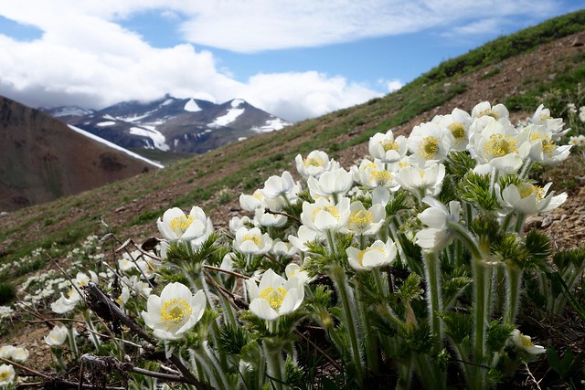
Chris N. in the Southern Chilcotins:
“Matt, Doug and I spent 4 days camped in Graveyard Valley in the Southern Chilcotins and exploring the surrounding ridges. Access was via the Hurley (thoroughly unpleasant but 2wd-able), the Tyaughton Lake road (washboard-y corners but 2wd), Taylor-Mud Connector (slick when wet descending to the Tyaughton Creek crossing but 2wd otherwise), Mud Creek FSR (excellent; very 2wd), Mud-Paradise FSR (one berm 2/3 of the way down the hill to Tyaughton Creek might be 2wd; pothole-y after hill but reportable 2wd beyond the Tyaughton Creek trailheads) and the Relay Creek FSR (totally not 2wd right from the start). The last road requires high clearance 4wd and lots of nerves. There’s channeling, creek crossings, deep rutting, mudpits, off-camber sections with exposure and one steep off-camber hill with bad traction. We spent 1/2 hour doing some road work (bring shovels!) and made it to the road end. But this road isn’t going to last many more years. Once on the trail, they are generally easy to follow but wet at this time of year. We spent most of our time off-trail up in the alpine though and encountered very little snow – even above 2500 m. Deer, wolf, bear and moose tracks abound. Saw a sow grizzly with 3 yearly cubs and a wolf. And met no-one else. An excellent trip to my favourite part of the province.”

Flower Forest

Skyline Divide, 26 Jun 2016

Phil A. on Skyline Divide:
“Mount Baker beckoned, and four Wanderungers answered the call with a perfect day hike along the Skyline Divide. After navigating the pockmarked road (low clearance cars beware), we set out through the woods. 450 m later we popped out into flower-peppered, emerald green, and a snow covered ridge line. From there, it was one spectacular view after the another, and an afternoon of hiking, laughing, and bum sliding. The ridge that runs towards Mount Baker seemed to go on forever, and a wise Wanderunger would do well to bring a tent to spend at least one night atop one of its numerous knolls. Sad that we couldn’t overnight, we turned back and headed to Sumas for some Mexican food.

Elevation Gain/Loss: 1200 m/-1200 m
Distance: 13.5 km (most of the trail is easy to follow, but some parts are still snow-covered).
Time: At a slow/moderate pace you can reach the ridge line in 1.5 hours. After that, you can go as far as you want. We went as far as N48° 50.527′ W121° 51.464′ before turning around.”

https://www.instagram.com/p/BHJjwFrAe3c/

Flora Peak, 25 Jun 2016

Phil A. on Flora Peak:
“Confident that the weather would clear up, your heroes set off to conquer Flora Peak in Chilliwack Lake Provincial Park. The hike was a good mix of mossy second-growth forest, alpine meadows, talus slope-scrambling, and ridge exploring. We also timed it perfectly, and the clouds parted as we reached to summit. No real snow except for a few north-facing patches. Rather than take the trail down, we ‘shwacked through the flower fields and got a fantastic view of Chilliwack Lake.

Elevation Gain/Loss: 1520 m/-1520 m
Distance: 12.7 km”

https://www.instagram.com/p/BHGrxn5A1Ki/

Slollicum Peak, 4 Jun 2016

Phil on Slollicum Peak:

“In search of a snowy summit on a scorching day, four intrepid Wanderung-ers headed to Slollicum Peak. After muscling our 4×4 up to the trailhead, it was a 4-hour hike on a moderately well marked trail. We were greeted with blooming flowers, the odd stinging nettle, and babbling brooks. The summit was snow covered, and offered a great 360 degree view of the hanging Slollicum Lake, Mt Baker, Harrison Lake, and the countless surrounding peaks.

Distance: 13 km
Elevation Gain: 1440 m
More hike information on Club Tread

https://www.instagram.com/p/BGSCveWtuJE/

Diez Vistas, 4 Jun 2016

Bob H. on Diez Vistas:
“Three of us went for a moderate to fast-paced hike to one of the most popular hiking trails in the Lower Mainland.

The weather was warm, but it was nice and cool under the forest canopy. Diez Vistas is Spanish for ten views.

Most people doing this trail complain that there are only 3 or 4 views (how sad, right?!). Anyways, I promised my fellow hikers 10 views and I actually gave them 11.

Five of the original views are obstructed by trees now, but there are 5 more views that were never ‘official’ vistas, including 3 on the east loop, which most people don’t know about. The 11th vista is actually on the Lakeview Trail, which we took a shortcut to. We finished the hike in 4 hours.

For more info on this hike, check out this blog: http://www.buntzenlake.ca/diez-vistas/

Original Vista No. 1 view